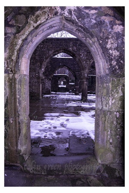
Showing posts with label Ruins. Show all posts

Saturday, 16 December 2023

Fiery Sky at the Ruins of the Church of St Thomas a Becket, Heptonstall

The picture below is the result of a little tinkering with replacing a washed-out overcast sky in a picture I took in November 2013 with a more adventurous sunset-type sky.

The picture shows the inside of the ruined church of St. Thomas a Becket, Heptonstall, a church built on the site of an earlier one in the 15th century. The church was damaged beyond repair in the 19th century and replaced by the Church of St. Thomas the Apostle, which occupies the same grounds as its predecessor.

I took the original pre-edited version of the picture on November 16, 2016 with a Samsung Galaxy Tablet; it can be seen un-watermarked on Clickasnap by clicking the image. The link opens in another window.

Thanks for looking, please take a moment to share and follow me on social media. You can also check out my Zazzle stores via the links in the sidebar. I also have a sales profile on Photo4Me.

The picture remains the copyright of Colin Green.

Sunday, 6 August 2023

Temple of Jupiter, Beirut - Vintage 1970's 35mm Slide

 The picture below is part of my 35mm slide collection, this one showing the ruins of the Temple of Jupiter, Lebanon. The original picture was taken in the 1970's and can be seen below the restored image.

The picture above was restored using a number of features on photoshop, it can also be seen un-watermarked on my Clickasnap account, click the image and a link should open in another window. The original picture can be seen below.

Clicking on the original picture should open a link in another window to my vintage images album on Clickasnap, all the pictures are dated pre 2000.

Thanks for looking, please take a moment to share and follow me on social media.

The pictures remain the copyright of Colin Green.

Saturday, 14 May 2022

Ruins of Staups Mill, Blackshawhead

 Built as a cotton mill in the mid to late 18th century, Staups Mill was originally known as Starling Mill and built alongside the then Blackshawhead Clough which was used to power it. Blackshawhead Clough was at the time of building of the mill the border between Lancashire and Yorkshire, it has become known more commonly as Jumble Hole Clough. The mill was largely damaged when a dam collapsed and caused water to rush down Jumble Hole Clough on the 24 September 1896 and there the story seems to end, other than the ruins that now remain.

I visited the area on the 4 May 2022, the path that passes the mill has had some trees put alongside it to prevent access to the mill area and signs have been erected warning of no access and private property. I can only assume this is because of what appears to be the unsafe nature of the remains of the building, I made no attempts to go anywhere near the building with that in mind as I was out to explore not upset the land owner. It was a shame as I would have liked to have pictured the mill from the other side where Jumble Hole Clough flows towards it.

A couple of things that struck me when I was heading back down the valley towards Hebden Bridge, why would you have ever built a mill there, I realise the water flow helps power the mill but it's a fair distance up or down the valley to nearby settlements for workers and access for transporting goods. The second thought i had was it must have been pretty bleak heading to and from work in the 18th and 19th centuries during the winter months.

There are a total of 9 pictures to see around the mill area, they were taken using a Nikon d3300 SLR.

Jumble Hole Clough flowing past Staups Mill, this was as close as I got to the
ruins and due to careful camera cropping it looks a lot closer than it was.


I thought this picture had a similar look to the ones of the Amityville House,
with the 2 windows like eyes at the top.

One of the streams flowing off the surrounding moors and fields into
Jumble Hole Clough, at one time this would have been me stood in
Lancashire looking across to Yorkshire.

The path away from the mill towards Blackshawhead.

I have recently been made aware that the remains of Staups Mill have been demolished.

Clicking any image should open a link in another window to the un-watermarked, higher resolution version on Clickasnap.

Thanks for looking and please take a moment to follow me and share on social media.

All the pictures remain the copyright of Colin Green.

Thursday, 30 December 2021

The Ruins of the Church of St Thomas a' Becket

 Built sometime in late 12th - early 13th Century, the Heptonstall Parish Church was known as the Church of St Thomas a' Becket. It was also known as the chapel The Chapel of St Thomas the Martyr. It was built to serve the communities of Heptonstall, Erringden, Langfield, Stansfield and Wadsworth. The Priests were appointed and paid for by the Vicar of Halifax as the church was to serve the people to the west of Halifax.

The church was closed for a time around the turn of the 16th Century due to the murder of a priest, it was said he had performed an illicit marriage ceremony. The church underwent renovations in the 14th, 15th, 16th and 17th centuries, and a new clock was installed in 1810. This was moved to the new church.

The church was damaged by a storm in 1847 which tore off the roof, damaged the tower and caused considerable damage to the churchyard. The church rate, a tax payable by all parishioners to support the parish church was insufficient to repair the damage. A new church was built in the same churchyard funded by voluntary subscription and this opened in 1854.

The church ruins still stand to this day and occasionally outdoor services are conducted in the remains of the St Thomas a' Becket. I took these pictures on the 19th November 2016 with a Nikon d3300, they can also be seen un-watermarked and higher resolution on Clickasnap. Click any image and a link will open in another window.


Clicking any image will open a ink in another window to the un-watermarked, higher resolution version on Clickasnap.

Thanks for looking and please take a moment to share and follow me on social media.

All the pictures remain the copyright of Colin Green.

Sunday, 22 September 2019

A Journey Through Brontë Country: Discovering Waterfalls and Wuthering Heights

Recently, while sifting through some old photos, I stumbled upon a collection I took in March 2014. These weren't just any pictures; they were from a memorable walk across the moors south of Haworth, a journey undertaken in search of the elusive Brontë Waterfall and the haunting ruins of Top Withens farmhouse. I've compiled a selection of these images into a short video, which you can now view below.

The Brontë Waterfall: A Hidden Gem

Our adventure began at the Brontë Waterfall, a modest yet captivating cascade nestled in the heart of Brontë Country. This area, renowned for its stunning natural beauty, holds deep connections to the legendary Brontë family. You'll find the falls are part of the picturesque South Dean Beck. Interestingly, the original bridge crossing the beck was swept away by flash flooding in 1989, only to be lovingly rebuilt the following year. A plaque now stands as a testament to its resilience.

Following the Trail to Top Withens

From the waterfall, we followed the Brontë Trail in a westerly direction, leading us deeper into the moorland expanse and eventually to the atmospheric ruins of Top Withens Farmhouse. It's truly difficult to fathom how anyone could have carved out a life in such a desolate and isolated spot, with only a couple of other farms for company – farms that were themselves abandoned in the 1870s and subsequently demolished.

Top Withens met a similar fate, abandoned around the same time. However, it experienced a brief revival in 1920 when a Mr. Ernest Roddie brought it back into use. Alas, its respite was short-lived, and by 1926, the farm was finally abandoned for good, left to slowly succumb to the elements and become the ruin we see today. This poignant shell of a home is widely believed to have been the inspiration for the iconic Earnshaw house in Emily Brontë's timeless novel, Wuthering Heights.


The pictures below are of the ruins at Top Withens. The full set can be seen in my earlier post on Top Withens. Clicking any of them should open a link in another window to my Colin Green Photography store on Zazzle.


The full set of 12 pictures at Top Withens can be seen on Clickasnap or my earlier blog post.

Please take a moment to share this post, follow me on social media, and check out my work on Photo4Me and Clickasnap using the links below.


All the pictures remain the copyright of Colin Green.

Saturday, 24 June 2017

Top Withins: The Inspiration for Wuthering Heights

The abandoned farmstead of Top Withins is said to have been the inspiration for Emily Brontë's novel Wuthering Heights. There is a plaque at the ruins that reads,

"This farmhouse has been associated with "Wuthering Heights", the Earnshaw home in Emily Brontë's novel. The buildings, even when complete, bore no resemblance to the house she described, but the situation may have been in her mind when she wrote the moorland setting of the Heights."

  • Bronte Society, 1964. This plaque has been placed here in response to many inquiries.

The farm was thought to have been built in the 2nd half of the 16th century and was lived in by the Sunderland family when the novel was published in 1847. The last known inhabitant was Ernest Reddy in 1926.

Top Withins: A Haunting Reminder of the Past

Top Withins is a ruined farmhouse located on the windswept moors of Yorkshire, England. It is said to have been the inspiration for Emily Brontë's Wuthering Heights, the classic novel of love, loss, and revenge.

The farmhouse is a haunting reminder of the past, its stone walls crumbling and its windows boarded up. But even in its dilapidated state, it still holds a certain magic.

Visiting Top Withins

Top Withins is a popular destination for fans of Wuthering Heights, as well as for those who simply enjoy the beauty of the Yorkshire Moors.

The farmhouse is located about 3 miles from Haworth, the village where the Brontë sisters lived. It is a short walk from the Brontë Waterfall, another popular tourist destination.

If you are planning to visit Top Withins, be sure to wear sturdy shoes and bring a jacket, as the weather can be unpredictable on the moors.

The History of Top Withins

Top Withins was built in the 16th century. It was originally a working farm, but it was abandoned in the early 20th century.

The farmhouse is now owned by the National Trust. It is open to the public, but it is not possible to go inside.

The Legend of Top Withins

There are many legends associated with Top Withins. One legend says that the farmhouse is haunted by the ghost of Emily Brontë. Another legend says that the farmhouse is built on the site of an ancient pagan temple.

Whether you believe in the legends or not, there is no denying that Top Withins is a truly magical place.

Conclusion

Top Withins is a must-visit destination for any fan of Wuthering Heights. It is also a great place to enjoy the beauty of the Yorkshire Moors.

If you are planning a trip to Yorkshire, be sure to add Top Withins to your list.

The pictures were taken using a Polaroid iS2132 camera in March 2014, clicking any image below should open a link in another window to my Colin Green Photography store on Zazzle.


Thanks for looking, and please take a moment to share and follow me on social media and check out my portfolio on Photo4Me via the link below.


All the pictures remain the copyright of Colin Green.

A Glimpse into London's Past: Unpacking a Postcard of Hyde Park Corner

There's something uniquely captivating about old postcards. More than just a simple message carrier, they offer a tangible link to the p...