Showing posts with label Tenterfields. Show all posts

Tuesday, 6 December 2022

Boxing Day Randoms.

 A set here I took using a Samsung Galaxy Tablet on Boxing Day 2013, whilst out for a walk blowing away the Christmas Day cobwebs. Not much to add only they were taken in the Sowerby Bridge to Luddendenfoot area.


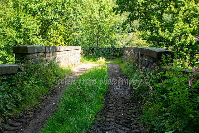
I've never discovered much about this building, it can be found by following a path from Tenterfields in the direction of Boulderclough and Luddendenfoot. I was once told it was part of Sagar Richards, which was an engineering company that occupy a sight to the north of the railway which passes to the right of the picture. There's no obvious signs that the sites were connected at the railway crossers a low bridge to the west of here which would have restricted access to larger vehicles.


This former mill pulley is on display in an apartment complex that occupies the former mills in the centre of Sowerby Bridge. Dugdales Mill can be seen in the background.


This stream runs through a private garden at Rose Grove to the west of Sowerby Bridge, the stream runs underneath the road in to the Rochdale Canal.


This former mill chimney long since disused offers a striking site in the centre of Sowerby Bridge, the road that runs past is the Old Cawsey an ancient packhorse route that was once the main road through the valley and Sowerby Bridge.


The 3 pictures above show Monkey Tunnel (no idea why it's called that). The tunnel runs underneath the railway line near Tenterfields Business Park.


Now offices and apartments this building was once the boiler house that helped Sowerby Bridge power that industry that built it from a hamlet alongside the River Calder into a town.


These rusty gates can be found near Trinity Academy, Sowerby Bridge, they were probably once one of the entrances to the school grounds, they have long since ceased to be used and have been left to rot, rust and decay.


This water culvert carries a water source from Sowerby underneath the railway in to the River Calder, it can be found near the red brick abandoned mill pictured earlier.


Willow Hall Drive is a private road that takes it's name from the nearby manor house. Despite being a private road it is accessible to cars and pedestrians.


The tree lined partially covered path leads up from the Hollins Mill area to the Friendly area of Sowerby Bridge.

Thanks for looking and please take a moment to share and follow me on social media.

Clicking any image should open a link in another window to the higher resolution version on Clickasnap.

All the pictures remain the copyright of Colin Green.

Friday, 4 January 2019

Unplanned Beauty: My Train Trip from Sowerby Bridge to Mytholmroyd

"Step aboard for a glimpse of a New Year's Eve train journey from Sowerby Bridge to Mytholmroyd! On December 31st, 2018, at approximately 11:15 am, with the carriage blissfully uncrowded, I decided to capture the passing scenery. My Nikon D3300 SLR was already mounted, and the thought of 'why not?' led to this spontaneous video.

Our westward journey commenced from Sowerby Bridge Railway Station Platform 1. Almost immediately, the iconic County Bridge, the majestic Town Hall Clock, and the gentle flow of the River Calder swept past. We then skirted Goodalls Transport, a reminder of the area's industrial past, built on the grounds of the former goods yard and near the original 1876 station site. The world outside then narrowed as we plunged into Cemetery Tunnel – known locally as Dixy Tunnel – burrowing beneath the serene Dixon Scar Woods and the peaceful Sowerby Bridge Cemetery. Though the tunnel section lasted a minute, I've fast-forwarded it for brevity in the video.

Emerging from the darkness, the landscape blossomed into open country as we sped towards Sowerby Bridge's Tenterfields, a once-bustling mill complex now humming with modern businesses. Next came the former VTL works, now a quiet haven for caravans within Fairlea Mills, followed by the historical echo of Luddendenfoot Railway Station, now repurposed into bustling industrial units.

Beyond Luddendenfoot, the rolling countryside stretched out again, punctuated by the blink-and-you'll-miss-it hamlet of Brearley, a scattering of homes and businesses barely discernible from the train. Finally, as Mytholmroyd drew near, the modern lines of Moderna Business Park peeked through the trees, and the venerable St. Michael's Church appeared as my cue to prepare for disembarkation.


Please take a moment to share this post, follow me on social media, and explore my work on Photo4Me and Clickasnap using the links below. Your support means a lot!


Wednesday, 18 July 2018

Dixon Scar Woods: A Hidden Gem in the Calder Valley

Nestled near the historic town of Sowerby Bridge, West Yorkshire, lies Dixon Scar Woods, affectionately known to locals as "Dixy Woods." This unassuming woodland, a sliver of green clinging to the steep hillside, offers a surprising escape into nature within a bustling industrial valley. Its unique topography, stretching from the tranquil banks of the River Calder at Hollins Mill up towards the solemn heights of Sowerby Bridge Cemetery, creates a diverse habitat and a captivating walking experience.

The woods are a testament to the region's industrial past, with the mainline railway slicing through its heart via the evocative Dixy Tunnel (or Cemetery Tunnel, as it's also known). This juxtaposition of nature and infrastructure adds a layer of historical intrigue to the landscape. Below, the valley floor reveals a patchwork of fields, the manicured expanse of Sowerby Bridge Cricket Club, and the ever-flowing River Calder, all overlooked by the verdant embrace of the woodland.

Exploring Dixy Woods reveals a network of paths, weaving through a tapestry of trees that change with the seasons. On September 7th, 2017, using a Nikon D3300, I embarked on a journey that began at the bridge spanning the River Calder at Hollins Mill. The path, initially hugging the river's edge, offered glimpses of the water's gentle flow and the valley's industrial heritage.

The lower reaches of the woods are characterized by a mix of mature deciduous trees, likely including oak, ash, and sycamore, providing a shaded canopy. The undergrowth, though perhaps dense in places, offered glimpses of wildflowers and the subtle signs of wildlife. The air, thick with the scent of damp earth and decaying leaves, carried the distant rumble of trains echoing through the tunnel.

As the path progressed, it led towards Tenterfields Business Park, a modern development marking the transition between Sowerby Bridge and Luddenden Foot. This section of the walk offered a contrast between the natural beauty of the woods and the more structured environment of the industrial park.

The journey culminated at Monkey Tunnel, a pedestrian passage that facilitates access from Tenterfields Bridge up towards the village of Boulderclough. This tunnel, a portal connecting different elevations and communities, symbolizes the way Dixy Woods acts as a bridge between landscapes and histories.

Clicking any of the images below should open a link in another window to my Colin Green Photography store on Zazzle.


Wood Lane Railway Bridge.


Hollins Mill Weir, this was damaged in the 2015 Calder Valley Boxing Day floods.


The tunnel, which can be found near Tenterfields Business Park is known locally as Monkey Tunnel.


Another of the damaged Hollins Mill Weir.


Footbridge over the River calder at Hollins Mill.


Footbridge over the River Calder at Tenterfields.


Thanks for looking, please take a moment to share and follow me on social media, and check out my portfolio's on Photo4Me and ClickAsnap via the links below.


All the pictures remain the copyright of Colin Green.

A Glimpse into London's Past: Unpacking a Postcard of Hyde Park Corner

There's something uniquely captivating about old postcards. More than just a simple message carrier, they offer a tangible link to the p...