Sunday, 16 October 2022

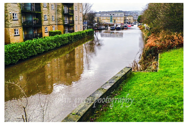
Ponders End Lock, February 2015

 A small set of pictures taken whilst on my lunch. I'd been to the nearby flour mill and whilst passing my lunch break by took these pictures of Ponders End Lock on the River Lee Navigation.

They were taken using a Samsung Galaxy Tablet on the 11th February 2015. There are 6 in total which can be seen below and on Clickasnap.


Thanks for looking, please take a moment to share and follow me on social media.

All the pictures remain the copyright of Colin Green.

Saturday, 15 October 2022

Cova de Can Marca, Port de San Miguel, Ibiza.


The Cova de Can Marca is a former smugglers cave near Port de San Miguel, Northern Ibiza. The entrance steps give outstanding views across the bay and Mediterranean.

The cave is one of the most popular attractions on Ibiza, taking approx 40 mins to tour and offering a show of water light and sound in a natural environment. The tour also included a light show based around natural waterfall that was once a natural feature of the cave.

The pictures were taken using a Polaroid is2132 bridge camera on the 12th July 2014, they can be seen below and on Clickasnap full size, resolution and un-watermarked.

Entrance steps to the cave


Exit stairs from the caves.

Clicking any image should open a link in another window to the version on Clickasnap.

Thanks for looking, please take a moment to share and follow me on social media.

All the pictures remain the copyright of Colin Green.

Wednesday, 12 October 2022

Mytholmroyd Railway Station October 2013

 Mytholmroyd Railway Station was opened in May 1847 by the Manchester & Leeds Railway with temporary platforms and buildings, several years after the railway was completed through the Calder Valley. These temporary buildings were replaced by a new station with platforms overhanging Mytholmroyd Viaduct in December 1871 and thats how things remained for over 100 years. In the 1980's some of the buildings that overhung the viaduct were removed, in 1985 the station became an unstaffed stop, and by the decades end the Grade II listed former ticket office and entrance had been bordered up and closed, after new platforms were constructed to the eastern end of the station, the platforms overhanging the viaduct were also removed around this time.

Mytholmroyd Station has limited facilities including a small car park, bus shelter cover on each platform and electronic ticket machines. No refreshment or toilet facilities can be found at the station. In the last full years of passenger numbers the station was used by 45912 passengers. This was for the year 2020/21 during the covid pandemic and was an approx average of 882 per week, down from an average of 3884 per week pre covid.

These pictures were taken using a Samsung Galaxy Tablet on the 26th October 2013. They can be seen below or on Clickasnap full size, resolution and un-watermarked.


Thanks for looking and please take a moment to share and follow me on Social media.

All the pictures remain the copyright of Colin Green.

Sunday, 9 October 2022

A few Water Shots From Brighouse. March 2019

 These pictures taken in March 2019 show various water based images taken around the Brighouse area. They were just randomly taken whilst out for a walk.

There are a total of 7 pictures which can be seen below and on Clickasnap full size, resolution and un-watermarked.

The Calder & Hebble Navigation towards Ganny Foot Lock

The Calder & Hebble Navigation at Brookfoot bend.

Brookfoot Lock on the Calder & Hebble Navigation.

The M62 Motorway over the Calder & Hebble Navigation at Brighouse.

Calder & Hebble at Cromwell Bottom.

The junction of the Calder & Hebble Navigation and River Calder at Brighouse.

The River Calder at Brighouse.

Thanks for looking and please take a moment to follow me and share on social media.

All the pictures remain the copyright of Colin Green.

Saturday, 8 October 2022

Remembering the Deluge: Sowerby Bridge and the 2015 Boxing Day Floods

 The Boxing Day floods of 2015 are etched into the memory of the Calder Valley. On that day, a perfect storm of relentless rainfall and already-saturated ground caused the River Calder and its tributaries to swell, bursting their banks and unleashing a wave of devastation. While towns like Mytholmroyd and Hebden Bridge were hit harder, Sowerby Bridge didn't escape the deluge. These images, rediscovered and shared, offer a powerful, on-the-ground look at the impact of the floods on our community.


A Town Submerged

The photos, taken with a Polaroid is2132 bridge camera, serve as a stark reminder of the sheer force of nature. One image shows the River Calder surging near the Turks Head Footbridge, its muddy waters completely overwhelming the usual banks. What is normally a peaceful river is transformed into a raging torrent, encroaching on picnic tables and threatening nearby buildings.

The sheer volume of water is evident in another photo, where the river completely surrounds the Lockhart Mills complex. The water level is so high it nearly reaches the windows on the ground floor, illustrating the scale of the damage. At the Gas Works Bridge, the river's high water levels are captured from two different angles, showing the water's menacing rise, swallowing trees and reaching the very edge of the footbridge.


The Unstoppable Flow

The flooding wasn't limited to the river alone. The Calder and Hebble Navigation canal system, a vital part of Sowerby Bridge's heritage, also succumbed to the pressure. Photos of Tuel Lane Lock show water cascading over the lock gates, an unsettling reversal of its typical function. The lock, designed to manage water flow, was completely overwhelmed, highlighting the extraordinary volume of rain that fell.

The images of the canal near Kirkham Turn and the Calder & Hebble Navigation show the water level rising to meet the surrounding land, turning the waterway into a vast, muddy lake. Houseboats, usually resting serenely, are caught in the swirling currents, their moorings tested by the floodwaters.


A Community's Resilience

While these pictures document the physical devastation, they also implicitly tell a story of resilience. The 2015 floods were the worst to hit the area since the 1960s, causing millions of pounds in property damage. Yet, from this shared hardship emerged an incredible community spirit. Neighbours helped neighbours, businesses were rebuilt, and the community came together to clean up the aftermath.

These photographs are more than just records of a flood; they are a testament to the power of nature and the enduring strength of the people who call the Calder Valley home. They remind us to respect our environment and to remember the challenges we have faced and overcome together.

The flooded Calder & Hebble Navigation and Rochdale Canals from Chain Bridge.

The Calder & Hebble overflowing at Chain Bridge.

Rochdale Canal from Tower Hill Bridge. The towpath can normally be seen to the
right of the canal, the small wall probably prevented the car park and nearby town
centre from further damage.

Tuel Lane Lock gates flowing over.

The River Calder flowing past Kingfisher Chase towards Lockhart Mills. The levels is
normally 15 - 20ft lower than this.

The flooded Kirkham Turn. This is where the Rochdale canal joins the Calder &
Hebble Navigation.

Flooding at Tuel Lane Lock on the Rochdale Canal.

Very High River Calder flowing past the Weaving Shed Apartments (right of picture) and
Dugdales Mill left of picture. Dugdales was severely flooded during this event.

River Calder at Gas Works Bridge, considering the damage done to Cromwell, Copley and
Elland Bridges, I was surprised that Gas Works Bridge still stood after the floods.

River Calder at Gas Works Bridge, looking more like a dam head than river crossing.

High level River Calder at Lockhill Mill, much of the red brick building was damaged beyond
repair by the flood and demolished the year after.

River Calder from above the Turks Head Beer Garden, the lower half of the iron footbridge
was just in to the flooded area. Dugdales mill storage yard can be seen heavily
flooded in the background.

Please take a moment to share this post, follow me on social media, and explore my work on Clickasnap and Photo4Me using the links below. Your support means a lot!


All the pictures remain the copyright of Colin Green.

November 2015: When the Calder Roared in Sowerby Bridge

The air in Sowerby Bridge felt different in November 2015. It was a time of unease, a prelude to a significant weather event that would fore...