The Calder Valley, a picturesque region in West Yorkshire, England, holds stories etched in its landscape, and among them is the tale of Copley Bridge. This blog post, inspired by historical accounts and evocative photographs, takes a look at the original Copley Bridge, a structure that stood for over 180 years before succumbing to the devastating Boxing Day floods of 2015.
The Original Copley Bridge: A Testament to 19th-Century Engineering
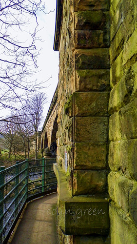
The Copley River Bridge, a two-arch stone bridge, was a vital crossing point over the River Calder, carrying North Dean Road. Its construction in 1831 was overseen by Richard Kennett-Dawson, the last Lord of the Manor of Copley. This historical detail highlights the bridge's significance as a private undertaking, serving the local community and connecting routes within the manor.
Our accompanying images offer a sepia-toned window into this bygone era. One photograph clearly shows the charming, octagonal toll house that stood beside the bridge, complete with its distinctive roof and shuttered windows. Another close-up of the toll board reveals the fees charged to cross, a common practice for privately built infrastructure of the time. "Motor Cars 1/6" and "Motor Cycle 6d" give us a fascinating insight into the early days of motorised transport and the various charges for different modes of passage, from horses and carriages to livestock. The inscription on the board, "BWKD 1833," likely refers to the "Copley Bridge Bar" being established or formally in use by that year, further reinforcing its private status. The notice also states that refusal to pay would result in being "considered a trespasser and treated accordingly."
The imposition of tolls, however, was not forever. In 1856, after 25 years, the fees were abolished, making passage across the bridge free for all.
A Path Through Time: The Bridge's Surroundings
The photographs also beautifully capture the serene, tree-lined path leading to and from the bridge, hinting at a quieter time. The sepia tone lends an air of nostalgia, emphasizing the passage of time and the history embedded in the very stones of the bridge and its surroundings. The presence of St. Stephen's Church in the background of one image further grounds the bridge within the historical and community fabric of Copley.
The Unforgiving Hand of Nature: Boxing Day 2015
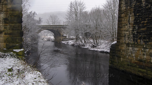
For 184 years, Copley Bridge stood strong, a silent witness to generations of local life and progress. However, on Boxing Day, December 26, 2015, the Calder Valley experienced unprecedented flooding. The raging waters of the River Calder proved too much for the historic structure. Copley Bridge was severely damaged, and ultimately, the decision was made to demolish its remains for safety reasons.
The story of Copley Bridge is a poignant reminder of both the resilience of human endeavour and the powerful, often unpredictable, forces of nature. While the original stone arches are gone, the legacy of Copley Bridge lives on in the new Wilson Bridge, continuing to connect communities and serving as a testament to the rich history of the Calder Valley.
This small set of pictures taken with a Samsung Galaxy Tablet 27th October 2013, Clicking any of them should open a link in another window to my Colin Green Photography store on Zazzle.
 |
| Copley Toll Booth |
 |
| Fee structure for crossing the bridge. |
The above fee board could be found on the side of Copley Toll Booth when I visited in 2013, I am not sure if the board is still there.


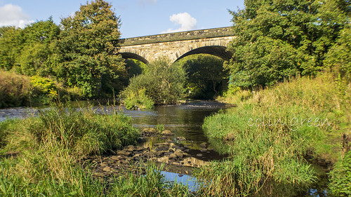
A scene that can never be repeated is this one of the Copley River (Toll) Bridge. The roof of St Stephen's Church can be seen with North Dean Woods behind.
Please take a moment to share this post, follow me on social media, and explore my work on Clickasnap and Photo4Me using the links below. Your support means a lot!


All images are the copyright of Colin Green.