Saturday, 28 December 2019

A Green Oasis with a Storied Past: Exploring West View Park, Halifax

Nestled in the Highroad Well area of Halifax, West View Park stands as a testament to Victorian philanthropy and a cherished green space for the community. Opened in 1896, this approximately 14-acre public park boasts a rich history, intriguing features, and a tranquil escape from the urban bustle.

The very existence of West View Park is thanks to the vision and generosity of two prominent local figures: Mr. Henry Charles McCrea and Mr. Enoch Robinson. Built on the site of a former quarry, the land itself was a donation from Lord Saville. McCrea and Robinson, driven by a desire to create a public amenity, funded the park's development on the condition that the local council would assume responsibility for its ongoing upkeep. This unique partnership ensured the park's longevity and its accessibility to all.

McCrea's influence is also evident in the park's name. "West View," he insisted, was a fitting moniker, reflecting the breathtaking vistas over the Norland Hillside, the distant Pennines, and the winding Calder Valley to the west of Halifax. Even today, these views remain a defining characteristic of the park, offering a sense of expansive beauty and connection to the wider landscape.

West View Park is not just a patch of grass; it's a meticulously designed space offering a variety of experiences. Visitors can stroll through formal gardens, enjoy the open spaces of the play areas, or simply relax on the terrace. It's a place where generations have come to unwind, play, and connect with nature.

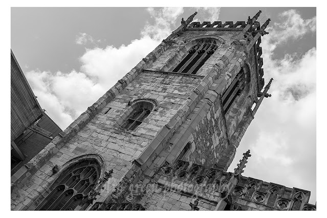
A poignant addition to the park's landscape arrived in 1904: a war memorial dedicated to the soldiers from the area who lost their lives in various conflicts. Standing proudly on the terrace area, the memorial commemorates two soldiers who perished in the Afghan Wars (1839-42 and 1878-81) and a significant 73 who died in the South African War (1899-1902). This impressive statue, reaching a height of 76 feet (23 meters), serves as a solemn reminder of the sacrifices made. Interestingly, its history isn't without incident; it was famously blown over in a gale in 1937. In the same year, three field guns that originally surrounded the memorial when it was unveiled were also removed. The memorial's historical significance was formally recognized on November 23rd, 1973, when it was granted Grade II listed status, ensuring its preservation for future generations.

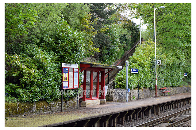
While the provided text makes a curious jump to a train station and tunnel, these details appear to relate to a different location and project a sense of confusion when associated with West View Park itself. It's important to clarify that the information regarding the level crossing, stream, bombing during WWII, and Winterbutlee Tunnel pertains to a railway station in the Todmorden area, not West View Park. The photographic details, however, confirm the dates and equipment used for capturing images of West View Park in February 2019, providing a recent snapshot of the park's appearance.

In essence, West View Park remains a vital part of Halifax's heritage. From its philanthropic origins and thoughtful design to its solemn war memorial and stunning views, it offers a blend of historical significance, natural beauty, and recreational opportunities. It's a place where the past and present intertwine, inviting visitors to reflect, play, and appreciate the enduring legacy of a truly remarkable green oasis.

Clicking any of the images below should open a link in another window to my Colin Green Photography store on Zazzle.


Please take a moment to share this post, follow me on social media, and explore my work on Photo4Me and Clickasnap using the links below. Your support means a lot!


All the pictures remain the copyright of Colin Green.

Saturday, 14 December 2019

4 from York

Not the usual haunts in York, I was there just doing some shopping with my wife and daughter in August 2019 and whilst I had my camera to hand, I didn't have the time to get around some of the more popular places in York.

They were taken near Waterstones Bookstore on Coney Street, York. Clicking any of the images should open a link in another window to my Colin Green Photography store on Zazzle.
Church tower of St Martin Le Grande

Coney Street

River Ouse towards Station Road Bridge

River Ouse towards Bridge Street

Please take a moment to share this post, follow me on social media, and explore my work on Photo4Me and Clickasnap using the links below. Your support means a lot!


All the pictures remain the copyright of Colin Green.

Sunday, 8 December 2019

Exploring Walsden: A Station Through Time

Walsden Railway Station, nestled amidst the dramatic Pennine landscape, might seem like a quiet outpost today, but its history is a fascinating tapestry woven with tales of Victorian ambition, wartime drama, and modern resurgence. Though now firmly in West Yorkshire, Walsden's railway story began when it was still part of Lancashire, a testament to the ever-shifting administrative boundaries that define our regions.

A Glimpse into the Past: The Original Station (1845-1961)

The very first Walsden station opened its doors in 1845, a product of the burgeoning railway era that connected communities and fuelled industrial growth. For over a century, it served the village, a vital link for passengers and goods. However, the post-war economic austerity of the early 1960s brought about widespread railway closures, and Walsden, sadly, was not spared. In August 1961, the station shut its doors for good, and the physical structures were swiftly demolished, leaving behind only echoes of its past.

Yet, a tangible piece of that original station endures: a sturdy metal footbridge, erected in 1890. This venerable structure, now providing a crucial connection between the platforms of the current station, is a silent witness to a bygone era. It's a poignant reminder that while buildings may fall, some elements, built with Victorian longevity in mind, can transcend generations. The original station itself was located to the west of this footbridge, stretching towards the entrance of the impressive Winterbutlee Tunnel.

A Troubled Crossing and a Wartime Bombing

The original station also featured a level crossing, a common feature of early railways but one that often brought its own dangers. Indeed, Walsden's crossing was, regrettably, the scene of several injuries and even deaths. The removal of this crossing paved the way for the current station's construction, a move that undoubtedly improved safety for both railway users and local residents.

Perhaps one of the most surprising anecdotes from Walsden's railway past is its unfortunate distinction as the only place in the greater Todmorden area to be bombed during the Second World War. While details are scarce in the provided text, this tidbit hints at the far-reaching impact of the conflict, even on seemingly remote Pennine communities.

Adding to the station's ongoing challenges, a stream runs directly underneath the station, close to the iron bridge. This natural feature, while picturesque, has a less charming side effect: during heavy rains, the station and the line are prone to flooding, a persistent battle against the elements for Network Rail and station users alike.

The Rebirth: Walsden's Current Station (1990-Present)

After nearly three decades of dormancy, Walsden Railway Station was reborn. In September 1990, a new station opened its platforms a few metres east of the original site. This resurgence was a testament to the growing recognition of the importance of local rail links, connecting communities and offering sustainable transport options.

Today, Walsden is an unstaffed station, characteristic of many smaller stops on the network. While facilities are limited to small shelters for protection from the notoriously unpredictable Pennine weather, modern conveniences have been introduced. Electronic information boards keep passengers updated, and ticket machines provide easy access to fares.

The station's viability is clear in its passenger figures. In 2017-18, Walsden averaged approximately 2,100 passengers per week, a healthy number for a village station and a strong indicator of its continued value to the community.

Winterbutlee Tunnel: A Feat of Victorian Engineering

No discussion of Walsden Railway Station would be complete without mentioning the impressive Winterbutlee Tunnel. Located to the west of the station, this 279-metre long tunnel is a remarkable feat of Victorian engineering. It was opened by the Manchester & Leeds Railway Company in 1841, a crucial component of the line that completed the connection between Todmorden and Littleborough. The tunnel stands as a permanent monument to the ambition and skill of the railway pioneers who carved routes through the challenging Pennine terrain.

A Photographer's Eye: Capturing Walsden

The provided information also gives us a glimpse into the art of capturing the station. The accompanying pictures, taken on August 27th, 2017, with a Nikon D3300 camera, offer a specific date and equipment detail. This reminds us that beyond the historical facts and figures, these locations are also subjects of contemporary interest, inspiring photographers to document their beauty and utility.

Walsden Railway Station, therefore, is more than just a stop on the line. It's a microcosm of railway history, a resilient survivor of closures, and a vital link in the modern transport network. From its Victorian origins to its present-day operations, it stands as a testament to the enduring power of the railways to connect people and shape landscapes.

Clicking any of the images below should open a link in another window to my Colin Green Photography store on Zazzle.
Manchester direction, the bridge is all that remains of the original station, it was built in 1890. Winterbuttlee Tunnel can be seen beyond.
Winterbuttlee Tunnel from the 1890 Bridge. The original Walsden Station was sighted near the tunnels entrance.

The 1890 metal footbridge is all that remains of the original station at Walsden. There used to be a level crossing where the gate is.

British Rail Class 144 Pacer train at the Leeds bound platform 2.


The steps up and over the 1890 bridge.


Please take a moment to share this post, follow me on social media, and explore my work on Photo4Me and Clickasnap using the links below. Your support means a lot!


All the pictures remain the copyright of Colin Green.

Tuesday, 3 December 2019

The Enduring Mystery of Settle Parish Church: A Glimpse into the Holy Ascension

Nestled in the heart of Settle, a charming market town in North Yorkshire, stands a building of quiet dignity and intriguing history: Settle Parish Church, officially known as the Church of the Holy Ascension. While its presence is a familiar landmark for locals and a picturesque addition to the town's landscape for visitors, delving deeper into its past reveals a captivating story, albeit one shrouded in a surprising lack of readily available information.

A Rickman Masterpiece in the Dales

The Church of the Holy Ascension bears the distinctive architectural stamp of Thomas Rickman, a name that resonates with those familiar with ecclesiastical architecture of the early 19th century. Rickman, a Quaker convert and a pioneer in the study of Gothic architecture, is credited with establishing the system of classifying Gothic styles (Norman, Early English, Decorated, and Perpendicular) that is still widely used today. His designs, often characterized by their elegant simplicity and adherence to Gothic principles, were a significant departure from the more classical styles prevalent at the time.

The consecration of Settle Parish Church on October 26th, 1838, marked a significant moment for the community. Imagine the scene: the excited congregation, the solemn blessing, and the sense of new beginnings as this impressive edifice took its place as the spiritual heart of Settle. While we lack specific details about the construction process or the local dignitaries involved, the very act of commissioning a church from a prominent architect like Rickman speaks volumes about the aspirations and resources of Settle in the mid-19th century. It suggests a growing population, a thriving community, and a desire for a substantial and aesthetically pleasing place of worship.

An Interior Evolving: The 1998 Remodel

While the exterior of the Church of the Holy Ascension largely retains Rickman's original vision, the interior has seen at least one significant transformation. In 1998, parts of the interior underwent a remodelling. This detail, though brief, sparks curiosity. What aspects were changed? Was it a restoration, an update to modernise facilities, or a reordering of the worship space to better suit contemporary needs? Without further information, it's a tantalizing hint at the church's ongoing journey and its adaptability over time.

Church remodels often reflect shifts in liturgical practice, changes in congregation size, or simply the need for maintenance and improvements. The 1998 work could have involved anything from updating the pews, altering the altar area, improving lighting and heating, or even creating new community spaces within the church. Each such alteration leaves its own layer of history, adding to the rich tapestry of the building's life.

The Enduring Mystery: A Call for Discovery

Perhaps the most intriguing aspect of Settle Parish Church, as highlighted by the original text, is the surprising scarcity of information available online. In an age where digital archives and historical records are increasingly accessible, it's genuinely remarkable that a building of this age and architectural significance remains somewhat of an enigma.

This lack of readily available information creates a compelling opportunity. For local historians, community groups, and indeed, anyone with a passion for architectural heritage, Settle Parish Church presents a genuine treasure hunt. Imagine the stories waiting to be unearthed:

  • Who were the key figures in Settle who championed the building of this church?
  • What challenges were faced during its construction in the 1830s?
  • Are there any surviving archives or local newspapers that shed light on the consecration ceremony in 1838?
  • What was the nature and extent of the 1998 remodelling, and what prompted it?
  • Are there any unique architectural features or historical artefacts within the church that deserve wider recognition?

A Call to Action (and Exploration!)

While the challenges of physical distance may prevent some from visiting in person, the mystery surrounding Settle Parish Church serves as a powerful reminder of the value of local historical research. For those fortunate enough to live nearby, a visit to the Church of the Holy Ascension offers a chance to connect directly with its history. A conversation with churchwardens, a browse through local archives, or even just an observant walk around the building could unlock a wealth of untold stories.

In a world saturated with information, the Church of the Holy Ascension in Settle stands as a beautiful testament to architectural heritage, a silent observer of centuries of community life, and a captivating enigma waiting for its full story to be told. It reminds us that sometimes, the most interesting histories are those we have yet to fully uncover.

The pictures were taken on August 23rd 2016 using a Nikon d3300 SLR camera. Clicking any of the pictures below should open a link in another window to my Colin Green Photography store on Zazzle.


Please take a moment to share this post, follow me on social media, and explore my work on Photo4Me and Clickasnap using the links below. Your Support means a lot!


All the pictures remain the copyright of Colin Green.

Monday, 2 December 2019

Cross Hills to Colne, An Early Morning Drive Through a Rural Setting.

I've just uploaded a couple of new dashcam videos to my YouTube channel, both featuring a trip along the A6028. This journey takes us from the level crossing at Cross Hills, West Yorkshire, all the way to the outskirts of Colne, Lancashire.


Video 1: A Real-Time Roll Through Cross Hills

The first video is a short, real-time clip that focuses on the drive through Cross Hills village. It's a quick glimpse of the immediate area around the level crossing, giving you a feel for the local surroundings as we start our adventure.

Video 2: Time-Lapse Dawn Drive to Colne

The second video is where the real magic happens. This is a 4x speed time-lapse of the entire journey from the level crossing right through to Colne. You'll see us pass through charming spots like Glusburn, Cowling, and Laneshawbridge. What makes this particular drive interesting is the lighting: we started in near darkness as dawn was just breaking behind the wagon. So, while the video begins with a distinctly nocturnal feel, the early morning light gradually floods the landscape by the time we reach our destination.

It's a fantastic way to see the transition from night to day and experience the changing scenery of this cross-county route. Let me know what you think of the videos in the comments once you've had a chance to watch them


They were filmed on my dashcam on Friday 29th November 2019.

Please take a moment to share this post, follow me on social media, and explore my work on Photo4Me and Clickasnap using the links below. Your support means a lot!


Sunday, 1 December 2019

Stocksmoor Station: A Quiet Stop on the Penistone Line

Stepping off the train at Stocksmoor Station, you immediately feel a sense of stepping back in time. As the fifth stop on the Penistone Line when heading from Huddersfield, it’s a place that truly embodies the term "rural stop." When I visited in May 2016, I was the sole soul on the platform, camera in hand, soaking in the stillness. It’s hard to imagine, given the quiet, that this station actually averages just under 400 passengers a week, based on 2017-18 figures.

A Station with a Story

Stocksmoor isn't just a quiet halt; it's a survivor. Opened way back on July 1st, 1850, this station has witnessed its fair share of railway history. It’s one of the last remaining stretches of double track on the line, serving as a vital passing loop for trains between here and Shepley. The entire line was converted to single track in 1989, but not before it fought off yet another closure attempt. And speaking of closures, Stocksmoor has been unmanned since 1966, when the first bid to shut down the line was successfully reversed.

Minimalist Charm

In terms of facilities, Stocksmoor is decidedly minimalist. You’ll find step-free access to both platforms, which is always a plus, but don't expect much else. There are no toilets or shops, and shelter from the elements is limited. On my visit, there was no ticket machine, electronic notification board, or even a passenger help point. I do understand, however, that a ticket machine has since been installed, which is a welcome addition.

Despite the lack of modern amenities, or perhaps because of it, Stocksmoor holds a unique charm. It’s a testament to the resilience of smaller railway lines and a reminder of a bygone era of train travel. If you’re ever exploring the Penistone Line, make sure to give Stocksmoor a moment of your time. You might just find yourself, like I did, as its only visitor, enjoying the peaceful solitude of a truly rural station.

Clicking any of the images below should open a link in another window to my Colin Green Photography store on Zazzle.


Please take a moment to share this post, follow me on social media, and explore my work on Photo4Me and Clickasnap using the links below. Your support means a lot!


All the images remain the copyright of Colin Green.

A Glimpse into Maritime History: Admiralty Pier, Dover Postcard

There's something uniquely captivating about old postcards. They're not just pieces of paper; they're tiny time capsules, offeri...