Saturday, 4 July 2020

Journey Back to 70's: 35mm Slides

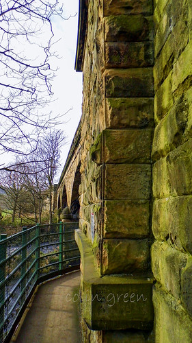
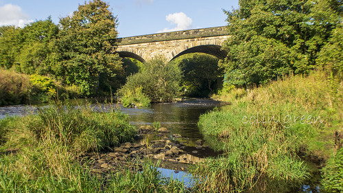
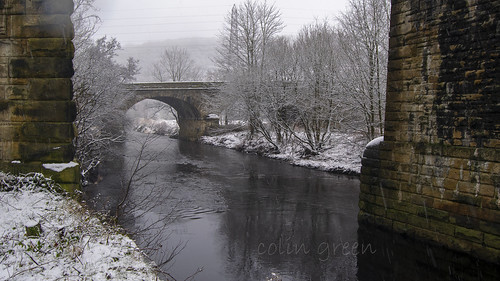
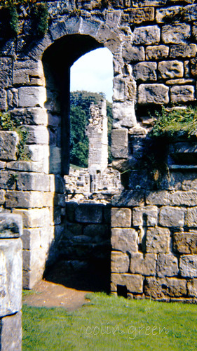
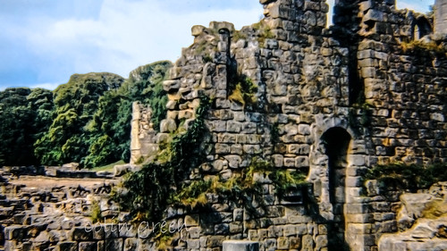
As a passionate collector of 35mm slides, I've spent years acquiring a fascinating array of photographic history. Now, I'm embarking on an exciting journey to digitize this collection, preserving these moments for years to come. What makes this particular endeavour even more special is that with each purchase, the copyright was assigned to me, allowing me to share these hidden gems.

Sadly, one of the challenges with these collections is the often-limited information available. Many slides come with little more than a place name and sometimes a date, leaving much to the imagination. However, the mystery only adds to the allure, inviting us to piece together the stories behind the images.

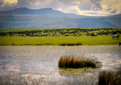
Among them is this stunning shot, captured in the breath taking Brecon Beacons, Wales, in July 1974. Just imagine the scene: the rugged peaks, the sweeping valleys, all bathed in the summer light of nearly fifty years ago. While we might not know the exact story of the person behind the camera, the image itself speaks volumes about the enduring beauty of this Welsh landscape.

The Brecon Beacons 1974

Take a step back in time with these two captivating images from July 1973, both captured at the stunning Farne Islands, Northumberland, England.

These snapshots perfectly encapsulate the bustling atmosphere as visitors gathered, either preparing to embark on a boat trip away from the islands or perhaps heading towards them – the exact destination remains a delightful mystery!

The Farne Islands, a cluster of islands off the Northumberland coast, have long been a haven for wildlife and a popular destination for nature lovers. It's fascinating to imagine the excitement and anticipation of those preparing for their island adventure over 50 years ago.

What do you think they were setting off to see? The famous puffins, seals, or perhaps the historic lighthouse?

Farne Islands Boat Trip 1973

Boat Trip Departing at Farne Islands 1973

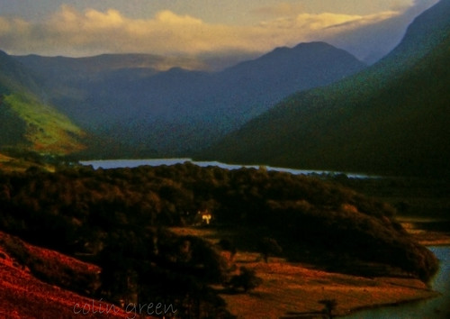
Sometimes, a single image can transport you back in time, offering a window into how places once were. We recently came across a fascinating photograph that does just that, capturing the serene beauty of the Lake District almost 50 years ago.

The fourth image in our collection, dated October 1978, presents a breath taking aerial view of Buttermere and Crummock Water reservoirs. From this elevated perspective, you can truly appreciate the dramatic landscape of the Lake District, with the two bodies of water nestled amidst the fells.

It's incredible to see how much, or how little, some of these iconic natural spaces have changed over the decades. While the surrounding infrastructure and visitor numbers may have evolved, the core majesty of Buttermere and Crummock Water, as seen in this 1978 shot, remains timeless.

This photograph serves as a wonderful reminder of the enduring appeal of the Lake District and the power of historical images to connect us with the past.

Buttermere & Crommack Oct 1978

Today, we stumbled upon a real gem in the archives – a photograph simply titled "Sussex Farm Dog." The image itself is striking, capturing a moment frozen in time from 1977.

But beyond that date and its evocative title, there's a beautiful mystery. We have no other information about this particular picture. Who was this dog? What was their name? What kind of life did they lead on that Sussex farm?

Looking at the photo, you can almost feel the sun on your face and smell the earth. Was this dog a working animal, diligently helping with the daily chores, or a beloved family pet, a loyal companion to a farmer or their children? Perhaps they were both. Their expression seems to hold a quiet dignity, a testament to a life lived close to the land.

This lack of information, rather than being a hindrance, actually sparks the imagination. It allows us to wonder, to create our own stories about this anonymous canine. The "Sussex Farm Dog" becomes more than just a picture; it becomes a symbol of rural life in England during the late 70s, and a reminder of the enduring bond between humans and their animal companions.

Sussex Farm Dog 1977

Clicking any image above should open a link in another window to my Colin Green Photography store on Zazzle.

Please take a moment to share this post, follow me on social media, and explore my work on Photo4Me and Clickasnap using the links below.


Copley's Gem: The Lesser-Known Viaduct with a Rich History

When you think of railway viaducts in Copley, West Yorkshire, your mind probably jumps to the impressive, sprawling 23-arch structure. But just a few meters south lies an older, equally fascinating piece of engineering that often gets overlooked: the Manchester & Leeds Copley Viaduct.

Opened in 1840, a full 12 years before its more famous counterpart, this 3-arch viaduct holds a significant place in railway history. It was built by none other than the legendary George Stephenson, a name synonymous with pioneering railway development. Its historical importance was officially recognized on July 19th, 1988, when it was granted Grade II listed status.

The line crossing this historic bridge served passengers until 1970, coinciding with the closure of Brighouse Station. While passenger services officially ceased on September 1st, 1986, the line continued to see use for goods transport and occasional diverted passenger services between 1970 and May 2000.

There were discussions in the 1980s about potentially single-tracking the line over the 23-arch viaduct and completely closing the 3-arch viaduct. While this might have created a fantastic walkway stretching from Milner Royd Junction to Greetland, Elland, and Brighouse, many, myself included, believe a railway line serves a far more valuable purpose.

The Manchester & Leeds Copley Viaduct stands as a testament to early railway innovation and the enduring legacy of engineers like George Stephenson. Next time you're in Copley, take a moment to appreciate this unsung hero of the railway world.

Clicking any of the images below should open a link in another window to my Colin Green Photography store on Zazzle.

Copley Railway Bridge

The following video features the images and can be seen here and on YouTube. Please take a moment to subscribe to my channel.


Summer and the Calder at Copley Railway Bridge

Copley Railway Bridge Through the Pillars

Copley Railway Bridge Arch

Please take a moment to share this post, follow me on social media, and explore my work on Photo4Me and Clickasnap using the links below. Your support means a lot!


All the pictures remain the copyright of Colin Green.

Wednesday, 1 July 2020

A Glimpse into 1970s North Yorkshire

Step back in time with me as we journey to North Yorkshire in 1975-1976, through a collection of recently digitized 35mm slides. These aren't just old photographs; they're windows into a bygone era, capturing the essence of the landscape and a touch of personal history.

The first three images in this series transport us to the serene and stunning Fountains Abbey, taken in September 1975. For those unfamiliar, Fountains Abbey isn't just any ruin; it's a magnificent Cistercian Monastery with a rich and extensive past. It was founded in 1132 and thrived for centuries until its dissolution in 1539 under the reign of Henry VIII, a pivotal moment in English history that dramatically reshaped the religious landscape.

Nestled just a few miles southwest of the charming city of Ripon, North Yorkshire, Fountains Abbey today stands as a testament to medieval grandeur and architectural prowess, even in its ruined state. These slides offer a unique perspective, showcasing how visitors experienced this historic site nearly five decades ago.

Clicking any of the images below should open a link in another window to my Colin Green Photography store on Zazzle.

Fountains Abbey

Fountain Abbey

Fountain Abbey

These two pictures, taken in August 1976, offer a fascinating window into the tiny hamlet of Booze, nestled in the heart of North Yorkshire. Back then, as in centuries past, the rhythm of life in Booze was dictated by the land – specifically, by farming and mining.

The surrounding area was rich in natural resources, with chert, lead, and slate all extensively mined nearby. These industries would have shaped the landscape, the community, and the daily lives of the people who called Booze home.

However, the history of Booze is also marked by tragedy. The hamlet was profoundly impacted by a devastating mining disaster in the late 18th century. In a horrific turn of events, 24 men and 2 ponies lost their lives when a mining operation inadvertently blasted into an underground lake. A staggering 18 of those men were from Booze, a loss that would have crippled such a small community and left an indelible scar on its collective memory.

These photographs, though taken almost 50 years ago, serve as a poignant reminder of Booze's unique heritage – a place where the beauty of the North Yorkshire landscape intertwines with a rich, yet often harsh, industrial past. They invite us to reflect on the lives of those who worked the land and braved the dangers of the mines, contributing to the fabric of this resilient corner of England.


Booze, North Yorkshire Old Mines

Harebells Booze North Yorks 1976

Step back in time with us to August 1976, as we explore the charming hamlet of Langthwaite in North Yorkshire.

Nestled within the breathtaking Yorkshire Dales National Park, Langthwaite holds a unique position as one of its most northerly settlements. What makes this village particularly stand out in the Dales is its unusual concentration of dwellings. Unlike many of the more spread-out farmsteads and hamlets typical of the area, Langthwaite boasts a closer-knit collection of homes, giving it a distinct character.

The upcoming pictures offer a rare snapshot of daily life in this picturesque corner of Yorkshire nearly five decades ago. Join us as we journey back to a simpler time and appreciate the enduring beauty of Langthwaite.

Langthwaite Village

Hills above Langthwaite

There's something truly special about stumbling upon a vibrant bloom, especially when it's unexpected. Recently, we captured a delightful moment in a Grassington garden, featuring a stunning Amaryllis plant in full flower.

While many associate Amaryllis with the festive cheer of winter holidays, these magnificent plants can grace us with their spectacular blossoms at various times of the year, depending on the specific variety and growing conditions. The one we spotted in Grassington was a true showstopper, its bold, trumpet-shaped flowers adding a brilliant splash of color to the lush garden setting.

It's a wonderful reminder of the diverse beauty that can be found in even the most tranquil of gardens. The vibrant hues of the Amaryllis stood out, a testament to nature's artistry.

Amaryllis Plant at Grassington, June 1977,

Please take a moment to share this post, follow me on social media, and explore my work on Photo4Me and Clickasnap using the links below. Your support means a lot!


The pictures remain the copyright of Colin Green.

Sunday, 28 June 2020

A Glimpse into the Past: A Postcard Mystery from My Collection

As a collector of postcards, I often find myself lost in the stories they silently tell – tales of travel, connection, and moments frozen in time. Today, I'm excited to share a couple of intriguing additions from my large collection, one of which presents a delightful little historical puzzle!

Take a look at this charming postcard:

The Priory, Llandogo Postcard

This particular card, featuring The Priory, Llandogo, Monmouthshire, Wales, carries a fascinating journey within its aged fibres. What immediately captivated me was the postmark: June 4th, 1954, from the picturesque town of Ross-on-Wye, Herefordshire. It was addressed to a "Chapman" at 36 Hill Road, West Worthing, Sussex – a lovely, tangible link to lives lived decades ago.

However, a closer inspection of the stamp has thrown a delightful spanner in the works! The stamp clearly depicts King George VI. For those familiar with British history, you'll know that King George VI sadly passed away in 1952.

This discrepancy immediately sparks a few questions:

  • Was the postcard truly posted in 1954? It's possible that a stamp from 1952 (or earlier) was still in use and valid for postage two years later. Royal Mail often allows for a period where old stamps remain valid after a new monarch accedes to the throne. This would be the most straightforward explanation.
  • Could the postmark be slightly misread or unclear? While I've checked it carefully, sometimes aged ink and paper can play tricks on the eyes.
  • Is there a less common scenario at play? Perhaps it was a special issue or a collector's item used unusually? (Though this is less likely for a standard postcard.)

This little puzzle only adds to the charm and historical value of the postcard for me. It's a tangible reminder that even seemingly simple artifacts can hold layers of history and intrigue. It also highlights the importance of scrutinizing every detail when exploring historical items!

The image itself, of The Priory in Llandogo, offers its own quiet beauty. Nestled in the heart of Monmouthshire, Llandogo is a village known for its stunning Wye Valley scenery. I can almost imagine the sender enjoying the tranquillity of the area before sending this snapshot across the country.

The Priory, Llandogo Postcard Rear

The postcard reads as best as I can as follows, if I can't make the word out I will just underscore
The Priory - Llandogo
Via Chepstow, Herefordshire.

Dear Denis, Eva and All,
We are having an enjoyable time here, had a v. wet journey on Saturday. Rain almost all the way. Arrived without Jerry at 3.00, had to wait at ____Jerry arrived 7.30 just as the dinner bell went the weather has been _______ __ ______ __ day was nice we walked to a beacon hill and villages ___ most of the rest of the card I unable to make out but it ends with, I hope you fix something up soon, love to you all ______Love from Hugh and Jerry.

The 2nd postcard I want to feature is of  Happy Valley, Llandudno, these are a set of gardens that are home to wildlife animals and plants and still popular today. Llandudno Pier can also be seen in the picture.

Please take a moment to share this post, follow me on social media, and explore my work on Photo4Me and Clickasnap using the links below.


Monday, 22 June 2020

A Glimpse into the Past: Happy Valley and Llandudno Pier, 1950

There’s something truly magical about holding a piece of history in your hands, especially when it’s a vintage postcard. Each one tells a story, not just of the place it depicts, but of a moment in time, a connection between people, and a glimpse into a bygone era.

Part of my own collection is this charming postcard, offering a serene view across Happy Valley Gardens in Llandudno, with the elegant town pier stretching out into the distance.


Frozen in Time: August 11th, 1950

What makes this card particularly special is its postmark: August 11th, 1950. Imagine the scene on that summer's day. Was it a family holiday, a romantic getaway, or a peaceful escape to the Welsh coast? The card itself doesn't tell us who sent it or to whom, but it invites us to ponder the lives connected by this small piece of cardstock.

In 1950, Britain was still recovering from the war years, but tourism was steadily re-emerging. Llandudno, with its grand Victorian architecture and stunning natural beauty, was already a popular destination. Picture the visitors strolling through Happy Valley, enjoying the vibrant flower beds, perhaps riding the cable car or the Great Orme Tramway, and then heading towards the pier for a leisurely walk, an ice cream, or even a paddle in the Irish Sea.


The Enduring Charm of Happy Valley and Llandudno Pier

Looking at the postcard, it's striking how much, and yet how little, has changed. Happy Valley Gardens remains a beautiful, tranquil oasis, nestled on the slopes of the Great Orme. It's still a place where you can find peace, enjoy panoramic views, and escape the hustle and bustle.

And the Llandudno Pier? It's as iconic today as it was 74 years ago. A magnificent example of Victorian engineering, it continues to be a focal point of the town, bustling with arcade games, kiosks, and people simply enjoying the sea air.

This postcard isn't just a picture; it's a window. It reminds us of the timeless appeal of Llandudno, a place that has welcomed visitors for generations. It also serves as a beautiful testament to the simple act of sharing a moment, a memory, and a view with someone far away.

Clicking the images below should open a link in another window to my Colin Green Photography store on Zazzle.

Happy Valley, Llandudno Postcard
 Posted to a Mr & Mrs R. Acton
34 Worsley Road
Lower Walton
Warrington
Lancs.

Happy Valley, Llandudno Postcard Rear
The text as best I can make reads as follows,

Llandudno, Thurs

Having a very enjoyable holiday and regret it is nearly over. Weather has been mixed, but we have not been forced indoors. Had some lovely tours, and found N. Wales as beautiful as ever.

Love Helga & Harry

Please take a moment to share this post, follow me on social media, and explore my work on Photo4Me and Clickasnap using the links below.


Sunday, 21 June 2020

Carter Bar: Where England Meets Scotland, History Meets Horizon


Perched atop the Redesdale Valley at a bracing 1371 feet above sea level, Carter Bar isn't just a point on a map; it's a dramatic threshold where England and Scotland embrace, a place steeped in history and blessed with breath taking vistas. If you've ever travelled the A68, approximately 58 miles southeast of Edinburgh or 45 miles northwest of Newcastle, you've likely encountered this iconic crossing, with the charming town of Jedburgh as its nearest neighbour.

A View to Remember, Whatever the Weather

Carter Bar is a magnet for passers-by, and it's easy to see why. The dedicated viewing area is almost perpetually dotted with visitors, cameras in hand, eager to capture the stunning landscapes that unfold before them. From this elevated vantage point, your gaze can sweep across the majestic Cheviot Hills, delve into the rolling expanses of the Scottish Borders, and stretch far into the untamed beauty of Northumberland.

But be warned: while the views are consistently spectacular, the weather can be a fickle companion. Such is the nature of an exposed, high-altitude crossing. Even on a summer's day, a chill wind can cut through, a stark reminder of its elevation. And don't be surprised to find lingering patches of snow well into late spring or even an early dusting in autumn – nature here plays by its own rules.

Stones of History: Marking the Divide

The precise line of the historic border between England and Scotland is unmistakably marked by two large, unassuming stones. These silent sentinels bear witness to centuries of ebb and flow between two proud nations, reminding us that while the landscape is continuous, a significant historical and cultural divide lies beneath our feet.

Echoes of Conflict: The Raid of Redeswire

Yet, Carter Bar is more than just a scenic viewpoint. It's a place where history resonates deeply. On a fateful day, July 7th, 1575, this very ground was the scene of the last major skirmish between the Kingdoms of England and Scotland – an event immortalized as the Raid of Redeswire. Imagine the clash of steel, the cries of battle, and the tension that must have hung heavy in the air as these two formidable nations vied for supremacy.

The Peacekeepers of the Marches: Truce Days

Before the unification of the crowns, the border regions were often volatile, prone to disputes and lawlessness. To maintain some semblance of order, a fascinating system of international law known as Truce Days, or March Law, was established. Carter Bar was a known venue for these gatherings. Here, cross-border grievances were heard and settled, overseen by the powerful Lord Warden of the Marches, individuals entrusted with the immense responsibility for the security of these borderlands.

These unique legal proceedings became obsolete after 1603, a pivotal year that saw King James VI of Scotland ascend to the English throne as King James I. The Union of the Crowns brought an end to centuries of often-fraught relations, rendering the need for March Law and its Truce Days unnecessary. The border, while still culturally distinct, was no longer a realm of frequent conflict and dispute.

A Moment Frozen in Time

Our own recent visit to Carter Bar on October 24th, 2018, captured with a trusty Nikon D3300 SLR camera, served as a powerful reminder of its enduring appeal. The crisp autumn air, the expansive skies, and the tangible sense of history made for a truly memorable experience.

So, the next time you find yourself traversing the A68, make sure to take a moment at Carter Bar. Step out, breathe in the fresh, often bracing, air, and let your gaze wander across the magnificent panorama. But more than that, let your mind wander through the rich tapestry of history that has unfolded on this very spot. For at Carter Bar, you don't just cross a border; you step into a living, breathing testament to the intertwined histories of England and Scotland.

Clicking any of the images below should open a link in another window to my Colin Green Photography store on Zazzle.


Please take a moment to share this post, follow me on social media, and explore my work on Photo4Me and Clickasnap using the links below. Your support means a lot!


All the pictures and video remain the copyright of Colin Green.

Sunday, 14 June 2020

My Ribblehead Viaduct Collection: A Journey Through Time and Stone

Here's an enhanced version of your blog post about the Ribblehead Viaduct, designed to be more engaging and in-depth:


My Ribblehead Viaduct Collection: A Journey Through Time and Stone

For enthusiasts of historical engineering and breathtaking landscapes, the Ribblehead Viaduct stands as an enduring testament to human endeavor. My personal collection of 17 photographs, with one rare shot from August 1976 and the remainder captured in April 2015, aims to offer a unique visual journey through its impressive history and majestic presence. You can explore these images across various platforms, including my Flickr, YouTube, and Clickasnap channels.

Subscribe to my YouTube channel to see more videos like this.

The Monumental Ribblehead Viaduct: A Symphony in Stone

Also known as the Batty Moss Viaduct, this magnificent structure is more than just a bridge; it's a 24-arch marvel that gracefully carries the historic Settle to Carlisle railway line across the picturesque Ribble Valley in North Yorkshire, England. Its sheer scale is awe-inspiring: stretching 400 meters long and reaching a towering 32 meters at its highest point, it proudly holds the title of the longest single structure on the Settle to Carlisle line, making it arguably the most famous. Each of its 24 arches spans approximately 14 meters, supported by foundations that plunge 7.6 meters deep into the earth.


A Tale of Grit, Sacrifice, and Victorian Ambition

The construction of the Ribblehead Viaduct was a monumental undertaking, fraught with challenges and human cost. Work commenced in either 1869 or 1870 (sources vary slightly) and concluded in August 1875. The sheer scale of the project demanded an enormous workforce, peaking at approximately 2,300 men. These navvies, along with their families, lived in temporary, often harsh, settlements that sprang up around the viaduct site. These makeshift towns had evocative names like Batty Wife Hole, Sebastopol, and Belgravia, offering a glimpse into the tough conditions endured by those who built this colossal structure. Today, the area where these settlements once stood, at the base of the viaduct, is recognized as a scheduled ancient monument, a poignant reminder of the lives lived and lost here.

Tragically, the construction came at a steep price. Over 100 men perished during the viaduct's creation, succumbing to accidents, altercations, and even an outbreak of smallpox. Beyond the workforce, more than 100 women and children from their families also lost their lives in these arduous conditions. Their sacrifice is solemnly remembered at the nearby St. Leonard's Church in Chapel-le-Dale, where a plaque stands as a lasting memorial to those who paid the ultimate price for progress.


From Blueprint to Reality: The Evolution of a Landmark

The vision for a railway route through this challenging terrain originated with the Midland Railway in the early 1860s. Despite initial attempts to withdraw from the planned line—a proposal firmly rejected by Parliament in April 1869—work defiantly began in November 1869. By July 1870, the foundations were underway, with the first stone ceremoniously laid in October 1870.

Interestingly, the initial plan called for 18 arches. However, a significant design change in 1872 led to the decision to build 24 arches, a modification that ultimately enhanced the viaduct's stability and aesthetic appeal. Despite this alteration, construction pressed forward with remarkable speed, and by the end of 1874, the stonework was gloriously complete. The first goods train rumbled across the viaduct in August 1875, followed by the inaugural passenger train in May 1876, marking the official opening of this engineering marvel to the world.


A Near Miss: The Battle to Save Ribblehead

The story of the Ribblehead Viaduct almost had a different, more somber ending. In the early 1980s, British Rail proposed closing the line, arguing that the prohibitively high cost of repairing the viaduct and other structures along the route made continued operation uneconomical. This sparked a fierce and passionate campaign to save the line.

Between 1981 and 1984, over £100,000 was spent on essential repairs to the viaduct, a clear indication of its deteriorating state. By the mid-1980s, the track across the viaduct had been reduced to single status, with a restrictive 20 mph speed limit imposed for safety. However, the tide began to turn. In November 1988, the viaduct was rightly granted Grade II listed status, a testament to its historical and architectural significance. By this time, a powerful and dedicated campaign group had mobilized, fiercely fighting the closure threat. Their relentless efforts, coupled with a notable increase in passenger numbers, ultimately secured the line's future. By 1989, the Settle to Carlisle line, and with it the Ribblehead Viaduct, was saved from closure, paving the way for major repairs that continued until 1991, ensuring its survival for generations to come.


Capturing History: My Photographic Approach

The majority of the pictures in my collection were taken on April 4th, 2015, using a Polaroid is2132 bridge camera. These modern shots aim to capture the viaduct's majesty in contemporary light, while the single 1976 image offers a rare glimpse into its past. For those interested in acquiring copies, un-watermarked versions of these photographs are available for purchase on Clickasnap.

The Ribblehead Viaduct continues to be a magnet for visitors. The Ribblehead Railway Station, located approximately half a mile south, serves as a gateway to this historic site. The surrounding area is incredibly popular with walkers, drawn by the dramatic landscapes and the awe-inspiring presence of the viaduct. For those seeking respite and refreshment, the Station Inn offers accommodation, food, and drink, all in the shadow of this iconic structure.

Clicking any of the images below should open a link in another window to my Colin Green Photography store on Zazzle.


The viaduct is pictured in August 1976, note it is still double track not being singled until 1985 when it was once again subject to closure threats.


At no stage when taking these pictures did I ever enter within the fenced off areas of the track, and I would not recommend anyone else does either.

Please take a moment to share this post, follow me on social media, and explore my work on Photo4Me and Clickasnap using the links below. Your support means a lot!


All the pictures remain the copyright of Colin Green.

A Glimpse into London's Past: Unpacking a Postcard of Hyde Park Corner

There's something uniquely captivating about old postcards. More than just a simple message carrier, they offer a tangible link to the p...