Sunday, 26 November 2023

Walking the Ghost Tracks: The Pickle Bridge Line

The Pickle Bridge Railway, a line that once linked Bradford and Huddersfield, now exists mostly as a series of ghosts in the West Yorkshire landscape. The line, which operated from 1881 to 1952, was a casualty of a common problem in the area: subsidence. While it's been closed for over 70 years, a walk along its former route reveals fascinating glimpses of its past life.

From Clifton to Bailiff Bridge

My first walk along the route began at the former site of the Clifton Road Viaduct. This three-arch viaduct, which led directly into Clifton Road Station, is no longer standing. The line then crossed the A644 Wakefield Road and the River Calder before joining the Caldervale Line. Today, the former trackbed is often a narrow, overgrown trail.

Further along the path, you come across the Thornhills Viaduct, a magnificent five-arch structure that still stands today. The sheer scale of the viaduct, seen from Thornhills Beck Lane below, is a powerful reminder of the engineering feat required to build this line. The path then continues, leading to an abandoned railway bridge stranded in the middle of a field between the viaduct and Birkhouse Road. This isolated structure, weathered and partially hidden by thick overgrowth, is a poignant symbol of the line's fate. The final stretch of this particular walk took me toward Bailiff Bridge. Here, the former railway crossing and the Birkhouse Road Bridge are still visible, marking the line's path through the village. These structures, now simply part of the local scenery, are a testament to the fact that even after being abandoned, the railway still leaves its mark on the land.

Clicking any of the images below should open a link in another window to my Colin Green Photography store on Zazzle.

 
The remains of Clifton Road Viaduct, the station occupied a spot along the wall pictured with the dirt track to the left the main access road.

Former track bed pictured between the remains of Clifton Road Viaduct and Thornhills Beck Viaduct.

The top of Thornhills Beck Viaduct, this was the southern side and was gated off as can be seen preventing access any further.

Thornhills Beck Viaduct, opened up I think it would make an interesting footpath - cycleway.

Another of Thornhills Beck Viaduct


These last 2 show an abandoned bridge in the middle of a low cutting in what seemed to have become a farmers field. Looking at the surrounding land and historic maps I can see no reason for it's existence as their were alternative crossings over the railway nearby in both directions.

The second set of pictures were taken on the 25th May 2014, starting at the bridge above they show the remains of the line up to the end of Red Lion (Wyke) Viaduct.


The Pickle Bridge line crossing over Birkhouse Lane, Bailiff Bridge

The line's remains at Bailiff Bridge, the town's former station used to occupy a spot to the right of the picture behind the trees.

All that remains of the bridge that crossed Lower Wyke Lane, Houses now occupy the former trackbed to the left of the picture.

The bridge that crossed over Bradford Road has been removed, leaving only the abutments as a reminder the railway passed here.

The Red Lion or Wyke Viaduct crossing over a small access lane off Bradford Road.

The top of Wyke - Red Lion Viaduct, I don't remember climbing up to the top but I must have as the picture here proves I did. The end of the viaduct was probably just beyond the trees,

Wyke - Red Lion Viaduct. The crossing suffered badly from subsidence resulting in a much reduced speed limit during its years of operation. The situation was so bad that by the 1980's permission was sought to demolish part of the Grade II listed Viaduct.

This partially overgrown bridge stands to the northern end of the demolished part of Wyke - Red Lion Viaduct, I'm not sure if it was separate or part of that structure.

Please take a moment to share this post, follow me on social media, and explore my work on Clickasnap and Photo4Me using the links below. Your support means a lot!


All the pictures remain the copy right of Colin Green.

Monday, 20 November 2023

Exploring the Unseen Heptonstall: A Walk Through History and Charm

Perched high above the Calder Valley, the ancient village of Heptonstall is a place of profound history and quiet beauty. While many visitors flock to its famous landmarks—the Ruined Church and its replacement—this collection of photographs, taken on a clear July day in 2020, offers a different perspective, focusing on the hidden corners and everyday charm of this historic settlement.

A Glimpse into Village Life

Heptonstall is not just a tourist destination; it is a living, breathing village of approximately 1,400 people. Its history is deeply rooted in the textile industry, particularly hand-loom weaving, a tradition that shaped the village’s unique architecture. The pictures capture this character beautifully, from the cobbled streets of Towngate to the sturdy stone houses that have stood for centuries.

One image shows a classic red telephone box, a vibrant splash of colour against the backdrop of a well-kept garden. This iconic symbol of British life, now a rare sight, feels perfectly at home in Heptonstall's timeless setting. Another shot frames a charming row of buildings on Towngate, including the village's post office, with its traditional signage and hanging baskets, a testament to the community spirit that keeps this place alive.

The Stories in the Stone

The houses themselves tell stories. One particularly grand building on Towngate, with its large windows and elegant stonework, stands out as a former high-status dwelling, perhaps a merchant's house from the village's prosperous past. Another photograph shows the former grammar school, now the Heptonstall Museum, its plain, solid facade a symbol of the importance of education in this community. The simple yet striking stonework of these buildings highlights the craftsmanship that went into their construction.

The village's narrow, winding streets feel like a journey back in time, a feeling enhanced by the lack of modern clutter. Heptonstall has featured in a number of TV shows, including the recent Shane Meadows drama The Gallows Pole, a story about the Cragg Vale Coiners. It is a fitting location for such a tale, as the leader of the coiners, "King" David Hartley, is buried in the village churchyard—a grim piece of history that adds another layer to the village's already-rich tapestry.

These photographs reveal the quieter side of Heptonstall, the side that locals and long-time visitors know well. They show a village that has adapted to modern life without losing its soul. Heptonstall remains a favorite spot for hikers and history buffs, a place where every cobbled street and every stone wall has a tale to tell. It is a village that lives up to its reputation as a stunning, historic gem in the heart of the Calder Valley.

Clicking the images below should open a link in another window to my Colin Green photography store on Zazzle.

The phone box found towards the lower end of Hetonstall is now I am told used as a library by the local community.

Towngate is the main route through the centre of the village.

The village's post office.

34 Towngate.

41A Towngate. The passge to the right leads to the former grammar school and museum and runs past the churchyard.

The grammar school and museum buildings, the fence to the right surrounds the lower part of the churchyard.

Please take a moment to share this post, follow me on social media, and explore my work on Clickasnap and Photo4Me using the links below. Your support means a lot!


All the pictures remain the copyright of Colin Green.

Saturday, 11 November 2023

A British Icon in a Winter Setting: The Morris Minor 1000

On a frosty December day in 2022, a charming piece of British motoring history was spotted, standing out brightly against the muted, wintery landscape of Bradford. A classic 1967 Morris Minor 1000, its vibrant red paint dusted with frost, was parked outside St. John the Evangelist Church on Bierley Lane, its timeless design a stark and beautiful contrast to the modern cars around it.

A Car of the People

The Morris Minor 1000 is a true British icon. It was in production for a remarkable 15 years, from 1956 to 1971, during which time an astonishing 850,000 models were built. The car was beloved for its simple, sturdy design and its reliable performance, becoming a staple of British roads and a symbol of post-war ingenuity. The photographs capture the essence of this beloved vehicle, from its distinctive curved silhouette to its compact size. The frost on the windscreen and the light snow on the pavement add a touch of nostalgic, seasonal magic to the scene.

A Moment in Time

The pictures, taken with a Nikon D3300, show the car from different angles, highlighting its unique features. From the front, its rounded headlights and classic chrome grille are prominent, while the side-view shot shows its smooth, aerodynamic lines and the distinctive hubcaps. The car's license plate, a vintage "RYU 948E," confirms its 1967 model year, a detail that adds to its historical authenticity.

The backdrop of the church and its graveyard adds a sense of place and permanence to the photographs. The car, a temporary visitor in this historic setting, creates a fascinating juxtaposition between the transient nature of everyday life and the enduring presence of architectural heritage.

The Morris Minor 1000 is more than just a car; it's a cultural artifact. It represents a simpler time and a distinct period in British manufacturing. To see one in such a pristine condition, still on the roads and clearly cherished by its owner, is a delight. It’s a testament to a design that has transcended time, continuing to turn heads and spark memories, even on the coldest of winter days.

Clicking the images below should open a link in another window to my Colin Green photography store on Zazzle.


Please take a moment to share this post, follow me on social media, and explore my work on Clickasnap and Photo4Me using the links below. Your support means a lot!


All the pictures remain the copyright of Colin Green.

Saturday, 4 November 2023

Asquith Bottom Mill: A Sowerby Bridge Survivor

The former Asquith Bottom Mill in Sowerby Bridge stands as a powerful testament to the region's industrial past, a hulking monument of brick and stone that has adapted to the changing times. These images, taken in April 2017, capture the mill complex in its current state as a mixed-use industrial estate, a fascinating blend of old and new.

A Legacy of Industry

Asquith Bottom Mill has a rich history, serving various purposes over the years, from a carpet mill to a wire and woollen mill. It was originally built by the Edlestons family, a name that many locals will recall with fondness. For those who grew up in the area during the 1980s, the sight of a vibrant red neon sign bearing the Edlestons name across the roof is a cherished memory, a beacon of a bygone era that has sadly since been removed. The mill's closure in the late 1980s and early 1990s marked the end of a significant chapter for the area.

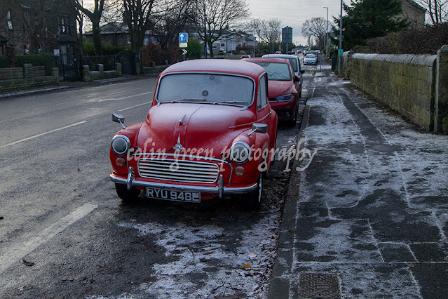
The photographs from 2017 reveal the sheer scale and character of the mill. The wide-angle shot shows the full facade of the main building, its rows of large, multi-paned windows a classic feature of mill architecture. The lower buildings in the foreground, with cars parked alongside, indicate the complex's modern function, a bustling hub for various businesses.

A Walk Through Time

Walking through the mill complex is like stepping into a living museum. One of the images captures a narrow ginnel or alleyway that runs between two buildings, with an overhead passageway connecting them. This architectural feature, common in industrial complexes of this size, speaks to a time when goods and people needed to move efficiently between different parts of the mill.

The details are what truly tell the story. A photograph of the building's exterior, shot at an upward angle, highlights the patina of age on the stone and the faded, closed-off windows, some of which still have their original frames. Another striking image, a black and white shot with a splash of red, focuses on a set of external stairs. These "red stairs," a pop of colour against the otherwise monochrome backdrop of the brickwork, lead up the side of one of the buildings, a dramatic and eye-catching feature that evokes a sense of both the mill's grand past and its slow, inevitable decline.

Asquith Bottom Mill, much like the surrounding landscape of Sowerby Bridge, is a symbol of resilience. It is a place that has not been forgotten but has been given a new purpose, a place where the echoes of industrial looms and the footsteps of mill workers still linger, even as new businesses thrive within its walls. These photographs serve as a poignant reminder of its past and a celebration of its enduring legacy.

Clicking any of the images below should open a link in another window to my Colin Green Photography store on Zazzle.

A vibrant memory from the mill's past stands in stark contrast to its present-day industrial hustle. Where the cars now sit parked in front of the mill, there once was a lush bowling green, a green oasis across the River Ryburn. The most striking change, however, was the mill's rooftop. For years, the building was crowned with a brilliant red neon sign that proudly displayed the W.M. Edlestons name—a familiar, glowing landmark that lit up the Sowerby Bridge skyline.

Once, goods and materials were hoisted to and from these doorways, but now, a lone hoist support juts out from the old brickwork, a silent reminder of the mill’s industrious past.


This picture was taken from the Norland hillside towards the back of the building. I don't imagine other than for safety checks that fire escape has been used in many years.
 
 Please take a moment to share this post, follow me on social media, and explore my work on Clickasnap and Photo4Me using the links below. Your support means a lot!


All the pictures remain the copyright of Colin Green.

Saturday, 28 October 2023

Washer Lane Aqueduct: A Hidden Relic of Halifax's Industrial Past

Tucked away at the entrance to the Washer Lane Industrial Estate in Halifax, a remarkable piece of local history stands as a silent sentinel. The Washer Lane Aqueduct, built between 1856 and 1873, is a striking relic from the town's booming industrial era. These images, captured on a lush June day in 2023, reveal its unique character and the fascinating story behind it.


A Landmark Built by an Industrialist

The aqueduct was constructed during the period when John Edward Wainhouse owned the Washer Lane Dyeworks. Wainhouse, a prominent figure in Halifax's industrial landscape, is perhaps best known for building the Wainhouse Tower, a flamboyant folly that dominates the local skyline . The aqueduct, while far less ornate, shares a similar connection to his industrial legacy.

The initials "J.E.W." are visible carved into the keystone of the arch, a personal touch that marks the structure as Wainhouse's creation. The aqueduct was originally built to carry water across the access road, a crucial component for the dyeworks which required a constant and clean supply of water for their operations.


A Quiet End to an Era

The dyeworks closed in 1896, and with its closure, the aqueduct's purpose came to an end. It has stood since as a picturesque, if unused, feature of the landscape. Without access to the top of the structure and with limited information available, it's safe to assume that the aqueduct no longer carries water.

Today, the aqueduct spans the top entrance road to the industrial estate, which runs down from Upper Washer Lane. The old cobbled road, flanked by high, moss-covered stone walls, passes directly beneath its stone arch. The entire scene feels like a journey back in time, a quiet corner of the valley where nature is slowly reclaiming the old industrial stonework.

The aqueduct is a hidden gem, a small but significant piece of Halifax's history that reminds us of the ingenuity and ambition of the industrialists who shaped the Calder Valley. It's a testament to a time when water was the lifeblood of industry and a reminder that even the most functional of structures can become a thing of beauty over time.

Clicking any of the images below should open a link in another window to my Colin Green Photography store on Zazzle.


The initials of John Edward Wainhouse can be seen on the centre stone of the aqueduct. Wainhouse owned the dye works from 1856 when he inherited them until he sold it to Henry Mossman in 1873. Because of the initials I think the aqueduct must date from this 17 year period.


Please take a moment to share this post, follow me on social media, and explore my work on Clickasnap and Photo4Me using the links below. Your support means a lot!


All the pictures remain the copyright of Colin Green.

Sunday, 22 October 2023

A Walk in the Rain: Exploring Brearley and the Route 66 Cycleway

There’s a unique beauty to the Calder Valley when it's raining. The greens become richer, the stone walls darker, and the atmosphere takes on a moody, contemplative quality. My recent walk, a loop starting from home in Sowerby Bridge and leading through Boulderclough and Mytholmroyd before returning along the Route 66 cycleway, offered a perfect, if soggy, opportunity to experience this.

The Murder Stone: A Dark Tale on a Pleasant Path

The Route 66 cycleway, is a well-loved trail for cyclists and walkers alike. As you pass through the hamlet of Brearley, just south of the railway bridge, you encounter a fascinating and rather macabre piece of local history: the memorial to William Deighton.

The "murder stone," as it's known, is a solemn reminder of a brutal crime. The memorial commemorates William Deighton, a tax inspector who was killed in Halifax while investigating the notorious coin counterfeiter "King" David Hartley and his gang. The stone, with its weathered, skeletal carving and a fragment of text, stands as a chilling artifact of a time when the law in this part of Yorkshire was a dangerous business. The photographs capture the stone in its atmospheric setting, nestled in the long grass beside the path, a quiet and unexpected monument to a violent past.

The path is part of the Route 66 cycleway (bridleway), with the railway bridge seen at the top of the picture and the green metal wall.

Underneath the skeletal artwork reads the following: A full and true account of a barborous, bloody, and inhuman murder. There is further artwork below this writing.

A Shelter, and a Soaking

Carrying on my walk past the former chapel, now converted into apartments, and through the heart of Brearley, the skies opened up. The rain, which had been threatening all morning, finally began to pour. Seeking shelter, I ducked under the arch of the Wheatley Royd Farm Bridge. It was a temporary reprieve, a dry spot from which I could watch the rain stream down the stone walls of the bridge and form rivulets on the path. The view from under the bridge, a framed shot of the lush, wet greenery beyond, was a beautiful moment of calm.

However, after nearly 30 minutes of waiting, with my weather app stubbornly refusing to offer any hope of a quick clearing, I conceded defeat. The path ahead called, and there was nothing for it but to embrace the inevitable soaking.

The images from the walk, from the striking memorial to the moody, rain-soaked landscapes of the Calder Valley, tell the story of the day perfectly. They capture the unique blend of history, nature, and unexpected weather that makes walking in West Yorkshire such a rewarding experience, even when you end up soaked to the skin.


Clicking any image should open a link in another window to my Colin Green Photography store on Zazzle.
 
Please take a moment to share this post, follow me on social media, and explore my work on Clickasnap and Photo4Me using the links below. Your support means a lot!


All the pictures remain the copyright of Colin Green.

Ince and Elton Railway Station

  Ince and Elton Railway Station, nestled in the heart of Cheshire, is more than just a stop on the line; it's a living piece of railway...