Showing posts with label Waterway. Show all posts

Monday, 2 December 2024

From Lock 1 to Hollins Tunnel: The Rochdale Canal

 The Rochdale Canal, a historic waterway winding its way through the picturesque landscapes of northern England, offers a tranquil escape for boaters and nature enthusiasts alike. This blog post will delve into the enchanting stretch of the canal from Lock 1 to Hollins Tunnel.

A Glimpse into History

The Rochdale Canal, completed in 1804, was a marvel of 18th-century engineering. Its construction revolutionized transportation and trade in the region. It was closed to navigation in 1952. Today, the canal serves as a popular leisure destination, attracting visitors from far and wide.

Lock 1 to Sowerby Bridge

The journey begins at Lock 1, Sowerby Bridge lower alongside the canal wharf. Passing through Lock 2 and the newly restored section from here to Bridge 1a Tower Hill. This section was infilled in the 1950's and a new road and car park were built over what was locks 3 and 4. This section of canal was restored in 1996 when Locks 3 - 4 were were replaced by Tuel Lane Lock and Tunnel, the deepest inland lock in the United Kingdom making possible the first full length navigation of the Rochdale Canal since 1937.

Sowerby Bridge: A Canalside Gem

Sowerby Bridge, a vibrant town nestled along the canal, is a highlight of the journey. The town's historic buildings, charming shops, and bustling market square offer a glimpse into its rich heritage. The canalside path is ideal for leisurely walks or bike rides, providing stunning views of the canal and the surrounding countryside.

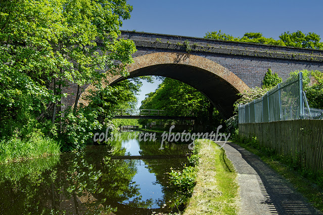
The Enigmatic Hollins Tunnel

The journey culminates at Hollins Tunnel, a short tunnel through the hillside. Constructed in the early 19th century, the tunnel was a significant engineering feat of its time. Today, it remains a fascinating relic of the industrial age still accessible by pedestrians, cyclists and boats despite being over 200 years old.

A Peaceful Retreat

Whether you're a seasoned boater or a casual visitor, the Rochdale Canal offers a truly unforgettable experience. The serene beauty of the canal, combined with the rich history and cultural heritage of the region, make it a must-visit destination. So, why not embark on a journey along this historic waterway and discover the magic of the Rochdale Canal for yourself.

The pictures below were taken in November 2013 with a Samsung Galaxy Tablet, clicking any of them will open a link in another window to my Colin Green Photography Zazzle store where merchandise featuring my images can be purchased.

I decided to give them a monochrome look to compensate for the Samsung Galaxy colours looking washed out. Clicking any of the images below should open a link in another window to my Colin Green Photography store on Zazzle.

Lock 1 Sowerby Bridge Lower, Sits on the edge of the canal basin, where the Rochdale Canal and Calder and Hebble Navigation meet.

Another of Lock 1, Lock 2 can be seen a short distance away.


Lock 2, Sowerby Bridge upper with the entrance to Tuel Lane Tunnel beyond. Growing up min the 1980's the area beyond the far locks gates was infilled and a grass embankment was in it's place.

Lock 3/4 Tuel Lane, the deepest canal lock in the United Kingdom at a depth of 19feet 8.5inches.

Bridge 1a Tower Hill Bridge, from the 1950's until the canal was re-opened in 1996 the canal terminated just the other side of the bridge, the section towards me forming part of a car park.

Co-op Bridge over the canal is thought to be at least 150 years old. It provided access from the nearby terrace housing to the mills down the valley. The canal tow path can not be accessed from the bridge.


The entrance to Hollins Tunnel.

Please take a moment to share this post, follow me on social media, and explore my work on Clickasnap and Photo4Me using the links below. Your support means a lot!


All the images remain the copyright of Colin Green

Wednesday, 29 May 2024

A Walk in Winter: The Calder and Hebble Navigation

These black and white photos capture the stark beauty of a winter scene along the Calder and Hebble Navigation. The path, blanketed in snow, winds its way alongside a still waterway. The trees lining the bank are bare, their branches reaching out like skeletal fingers towards the inky sky.

The absence of color in this photo only heightens the sense of tranquility. The world seems hushed, blanketed in a peaceful silence. Footprints visible in the snow are likely those of lonely hikers, making the viewer feel as though they are a remote person in this isolated landscape.

The Calder and Hebble Navigation is a 21-mile canal in West Yorkshire, England. It was built in the late 18th century to connect Sowerby Bridge with Wakefield. Today, the canal is a popular spot for walking, cycling, and boating.

This photo is a reminder that even in the depths of winter, there is beauty to be found in the natural world. The stark contrast of the black and white tones highlights the simple elegance of the scene. The stillness of the river and the bare branches of the trees create a sense of peace and tranquility.

If you're looking for a place to escape the hustle and bustle of everyday life, the Calder and Hebble Navigation is a great option. A walk along the canal towpath is a chance to connect with nature and appreciate the beauty of the season, whatever the weather.

In addition to its natural beauty, the Calder and Hebble Navigation is also steeped in history. The canal was an important transportation artery during the Industrial Revolution, and there are a number of old mills and warehouses along its banks. Today, these buildings have been converted into homes, businesses, and arts centers.

Whether you're interested in history, nature, or simply looking for a place to relax, the Calder and Hebble Navigation is a great place to visit. So next time you're in West Yorkshire, be sure to take a walk along this historic waterway. You might just be surprised by the beauty you find.

The pictures below were taken on the 17th January 2016 with a Nikon D3300 Camera, clicking any of them should open a link in another window to my Colin Green Photography store on Zazzle.

The canal pictured looking away from Walker Lane Bridge towards Chain Bridge. The Sowerby Bridge Gas Works and Gasometers used to occupy a site to the left of the picture just beyond the trees, the gasometers have long since been removed.

The canal is pictured here between Hollas Lane Bridge (Sterne Mills Bridge) and Edwards Road Bridge (Canal Mills Bridge). Both Bridges tend to known by either name, the land to the left of the picture has been redeveloped in to Copley Valley a mixed use zone of housing, industry and nature areas since this picture was taken. The land to the right of the picture may also face redevelopment in the coming years, it was for a number of years a car park for the Halifax Bank's Copley Data Centre, this has been closed for a while now with the data set to close and be sold off in the near future.

The canal towards Mearclough Canal Bridge, the waterway narrows a little here, often wondered why.

The colour versions can be seen below.


Please take a moment to share this post, follow me on social media, and explore my work on Clickasnap and Photo4Me using the links below. Your support means a lot!


All the pictures remain the copyright of Colin Green.

Saturday, 9 March 2024

Discovering the Charm of the Huddersfield Broad Canal: Aspley to Turnbridge

The Huddersfield Broad Canal, also known as Sir John Ramsden's Canal, is a hidden gem winding its way through Kirklees, England. This 3.75-mile waterway, adorned with nine wide locks, boasts a rich history dating back to the 18th century.

Originally built to serve the thriving textile industry, the canal played a crucial role in transporting coal and finished goods. Nicknamed the "Broad Canal" to distinguish it from its narrower counterpart, the Huddersfield Narrow Canal, it witnessed the industrial revolution unfold along its banks. Today, the canal stands as a testament to the region's industrial heritage, offering a glimpse into the past.

While its industrial days may be behind it, the Huddersfield Broad Canal has found a new purpose as a haven for leisure activities. Whether you're a keen boater, a cyclist seeking a scenic route, or simply someone looking for a peaceful walk, the canal caters to all.

For boaters, the canal offers a tranquil journey, connecting the Calder and Hebble Navigation at Cooper Bridge with the Huddersfield Narrow Canal near Aspley Basin. For those who prefer dry land, the towpath alongside the canal offers a scenic walking or cycling path. The gentle incline makes it suitable for all fitness levels, allowing you to soak in the picturesque surroundings at your own pace.

The Huddersfield Broad Canal is a reminder of the transformative power of historical waterways. From its industrial roots to its current role as a leisure destination, the canal continues to offer a unique and enriching experience for visitors and locals alike. So, next time you're in West Yorkshire, take a step back in time and explore the charm of the Huddersfield Broad Canal.

The pictures shown below were taken while walking the canal on the 27th May 2023, the first set featured were taken on the stretch between the Narrow Canal at Wakefield Road Bridge to the historic Turnbridge. Clicking any of them should open a link in another window to my Colin Green photography store on Zazzle.

Aspley Marina from Wakefield Road Bridge.


The end - beginning of the Huddersfield Narrow Canal, a short distance to the west of Wakefield Road Bridge and Aspley Marina.

Underneath Wakefield Road Bridge, Aspley Wharf at the tunnels end.

Aspley Wharf Moorings.


Please take a moment to share this post, follow me on social media, and explore my work on Clickasnap and Photo4Me using the links below. Your support means a lot!


All the images remain the copyright of Colin Green.

Saturday, 17 February 2024

Whispers of the Past: Discovering the Hidden Gem of Oxygrainz Clough

Amongst the heather-clad moors of Rishworth, on the edges of West Yorkshire, lies a hidden gem: Oxygrainz Clough and Bridge. This charming spot offers a peaceful escape for nature lovers and history buffs alike, combining stunning scenery with intriguing remnants of the past.

As you approach the clough, the ancient packhorse bridge, believed to date back to the 16th or 17th century, stands proudly, a silent witness to centuries of travellers and goods traversing the moors. Imagine weary traders leading laden horses across its weathered stones, carrying essential supplies between villages and markets. The historic bridge was replaced when the Oldham Turnpike was constructed a few metres to the north, allowing for larger goods traffic to cross between Lancashire and Yorkshire.

The clough itself unfolds like a verdant secret garden. A babbling brook meanders through moss-covered stones, whispering tales of a bygone era. Lush greenery carpets the banks, offering a vibrant contrast to the heather-dominated moors above. Sunbeams dance through the leaves, creating a magical, dappled light on the forest floor.

Your exploration doesn't have to end here. Rishworth Moor itself beckons with further adventures. Hike to the summit for panoramic views of the surrounding countryside, marvel at the ancient standing stones steeped in myth and legend, or visit the historic village of Rishworth with its charming pubs and traditional cottages.

The pictures below show the area around both bridges and the clough. They were taken in December 2020 with a Nikon d3300. Clicking any of the images should open a link in another window to my Colin Green Photography store on Zazzle.

The A672 Oldham Turnpike connects Oldham with Ripponden, the bridge replaced the much smaller Oxygrainz Bridge below which was once the packhorse route connecting the 2 towns.

Old and new, the original packhorse bridge, and the replacement turnpike bridge beyond.


Oxygrainz Clough flowing under the packhorse bridge and down Rishworth Moor, eventually reaching Booth Wood Reservoir.

The turnpike bridge viewed from the north side looking south. The M62 motorway is just beyond the hills peak.

Please take a moment to share this post, follow me on social media, and explore my work on Clickasnap and Photo4Me using the links below. Your support means a lot!


All the pictures remain the copyright of Colin Green.

Wednesday, 27 December 2023

An Urban Escape on the Rochdale Canal

The Rochdale Canal offers a peaceful, flat, and easy walk, even through the urban sprawl of Sowerby Bridge. This 1-mile stretch from Rose Grove Bridge (3) to Tower Hill Bridge (1A) is a perfect escape, taking you through some of the canal's most interesting features.


From Rose Grove to the Tunnel

Our journey begins at Rose Grove Bridge, a classic stone-arched bridge that feels a world away from the town's bustle. The path is a tranquil, tree-lined track with the canal running alongside. The water here is calm, reflecting the trees and sky beautifully, creating a sense of peace. As you walk, you'll hear the gentle sounds of nature and the lapping of water, a calming soundtrack for your stroll.


The Hollins Tunnel

After a short walk, the path leads to the Hollins Tunnel, also known as the Cemetery Tunnel. This is an incredible sight, with its moss-covered stone archway providing a dramatic entrance. The tunnel is a feat of engineering, and a walk through it feels like stepping back in time. The reflection of the tunnel's mouth on the still water inside is a remarkable sight, highlighting the symmetry and craftsmanship of its construction.


The Final Stretch

Once you emerge from the tunnel, the canal curves towards Sowerby Bridge. The path becomes more open, offering glimpses of the town's historic buildings and the impressive hillside landscape. You'll pass under the Co-Op Bridge, an old railway bridge with a modern twist, and finally, arrive at Tower Hill Bridge (1A).

This final section is especially interesting as it marks a point of historical change. The Rochdale Canal, once a bustling commercial waterway, was infilled here in 1952. The waterway was effectively cut off at Tower Hill Bridge, and this part of the canal now connects to the Tuel Lane Tunnel, which opened as part of the canal's restoration. This restoration and reconnection of the Rochdale Canal have allowed this scenic path to be enjoyed by walkers and nature lovers once again.

Clicking any of the images below should open a link in another window to my Colin Green photography store on Zazzle.

These two pictures show both sides of Bridge 3 High Royd.


These two pictures show the stretch of Canal towpath between Rose Grove, High Royd Bridge and Hollins Tunnel.


Inside Hollins Tunnel.

Hollins Tunnel entrance on the Sowerby Bridge side.

The canal curbing towards Sowerby Bridge, the Co-Op bridge visible crossing over the canal. The bridge provides access to Hollins Mill Lane from the Industrial Road area of Sowerby Bridge, but does not give any access to the canal.

The canal underneath Bridge 1A. In 1952 the canal was infilled from just beyond the arch, the bridge was also known as Tuel Lane Bridge until the road that crossed over it was rerouted and then it was changed to Tower Hill Bridge. The tower block is Ladstone Towers, built when large areas of low quality housing around the area was demolished in the mid 1960's.

Please take a moment to share this post, follow me on social media, and explore my work on Clickasnp and Photo4Me using the links below. Your support means a lot!


All the pictures remain the copyright of Colin Green.

Saturday, 16 September 2023

The Whitacre Mill Viaduct

Nestled in the green landscape of Deighton, near Huddersfield, the Whitacre Mill Viaduct is a silent witness to a bygone era of railway expansion. This impressive, disused railway bridge stands as a testament to the ambitions of the London & North Western Railway and its plan to connect Huddersfield with the Barnsley coal mines via the Kirkburton Branch Line.


A Bridge with a Story

Construction on the viaduct began in March 1865. Despite a partial collapse in February 1866, the viaduct was completed in time for the line's opening in October 1867. Although the grand plan for the railway was never fully realized, the viaduct served a short section of the line until its final closure in December 1971. Today, it stands as a monument to its industrious past, crossing the Huddersfield Broad Canal, the River Colne, and the valley below.


A Path Less Traveled

While the viaduct is largely overgrown on one side, it offers a unique walking experience from the Deighton side. Although challenging to navigate, the path provides a sense of adventure and a connection to the area's history. There are plans by Kirklees Council to transform the viaduct into a greenway, much like the nearby Bradley Viaduct, which would open this piece of history to a wider audience. Until then, it remains a secluded and beautiful spot, waiting to be rediscovered.

The pictures below were taken on the 27th May 2023 with a Nikon d3300.

The viaduct crossing the Huddersfield Broad Canal.

The top of the viaduct is supposed to be blocked off, I took this from the access point that has been removed. You can get approx. 2/3 of the way across before the bushes become to thick to pass, walking along the top of the wall would have allowed me to get further but I'm not great with heights, so I thought better of that idea.

Huddersfield Broad Canal pictured from the viaduct, Longlands Lock number 4 is just visible at the top of the picture.

The Huddersfield Broad Canal from Whitacre Mill Viaduct. The picture was taken in the direction of Huddersfield.

The overgrown former track bed looking towards the fence off access. The hole in the fence can be seen to the right of the picture if you follow the wall to the trees.


Please take a moment to share this post, follow me on social media, and explore my work on Clickasnap and Photo4Me using the links below. Your support means a lot!'


All the pictures remain the copyright of Colin Green.

The Skyline Across the Water: Dating a View of Ottawa from My 35mm Slides

This latest slide from my collection takes us far across the Atlantic to North America, capturing a beautiful panoramic view of a city skyli...