Sunday, 4 June 2017

The Halifax Branch of the Calder & Hebble Canal: A Lost Waterway

Just a whisper of its former self, the Halifax Branch of the Calder & Hebble Canal now stretches a mere half-mile from Salterhebble Junction and its locks to the Watermill Bar at Salterhebble Wharf. This truncated remnant is all that remains of a once vital artery that pulsed with industrial life.

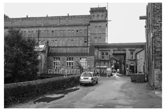
Opened in 1828, the canal climbed a formidable 14 locks to its original terminus at Bailey Hall, a location now occupied by the bustling train station and the interactive Eureka! museum. Imagine the scene: barges laden with goods, lock keepers busy at their work, and the constant hum of industry. But the rise of the iron horse and the advent of tarmac roads spelled the canal's decline. By 1942, the upper section, from Salterhebble Wharf to Bailey Hall, was abandoned, its waters drained and its towpaths reclaimed. Today, the Hebble Trail, a popular cycle and pedestrian route, winds its way along the canal's former path, offering little hint of the waterway that once flowed there.

While whispers of reopening this lost stretch occasionally surface, fueled by hopes of boosting Halifax's tourism, such dreams face a stark reality. A more visionary local council might seize the opportunity to resurrect this historic waterway, but with tight budgets and a perceived lack of ambition, the chances of seeing barges once again navigating through the heart of Halifax seem, sadly, remote.

The pictures were taken on April 9, 2017, using a Nikon D3300 camera. Clicking any image should open a link in another window to my Colin Green Photography store on Zazzle.
The start of the Halifax Branch, Salterhebble Locks are just to the
left of the picture out of sight. The bridge in the distance carries the
Halifax - Brighouse stretch of railway and crossers the canal which is
heading in the direction of Sowerby Bridge.


Wakefield Road Bridge. The canal brakes off to the left just beyond the bridge
through Salterhebble Locks in the direction of Brighouse.

The abutment to the right used to support a bridge that crossed the
canal here. The bridge has long since been removed.


Salterhebble Moorings can be seen in the distance. Tihs
is where the canal now ends.


To the right of the Watermill Bar is Salterhebble Tunnel. The canal continued through
 there and immediately entered lock 1 of the 14 on exiting the tunnel. The stone lock
walls can still be seen.

The modern day end of the Halifax Branch Canal. The Watermill Bar and
 Restaurant occupies what was the site of Salterhebble Mills. There is
also a Premier Inn hotel on the site,


Thanks for looking, and please take a moment to share and follow me on social media and check out my portfolio on Photo4Me via the link below.

 
All the pictures remain the copyright of Colin Green.

Saturday, 27 May 2017

Asquith Bottom Mill, Sowerby Bridge November 2013

The sprawling Asquith Bottom Mill, a vibrant mixed-use industrial estate in Sowerby Bridge, West Yorkshire, has a rich and varied past woven into its very fabric. Built around the bones of a former industrial giant, the complex has housed everything from carpet manufacturing to wire drawing and woollen production, depending on which era you're talking about. Originally established by William Edleston, the mill held a prominent place in the town's landscape. I can still vividly recall the striking red neon Edleston sign emblazoned across the roof in the 1980s – a nostalgic beacon that, sadly, is no more. The mill's hum fell silent sometime in the late 80s or early 90s, marking the end of an era for this local landmark
 
The pictures below were taken in November 2013 using a Samsung Galaxy Tablet. Clicking any image should open a link in another window to my Colin Green Photography store on Zazzle.


Thanks for looking, and please take a moment to share and follow me on social media and check out my portfolio on Photo4Me via the link below.


All the pictures remain the copyright of Colin Green.

Saturday, 8 April 2017

Peñas del Cache: Lanzarote's Majestic Summit

Peñas del Cache, reaching a height of 672 meters above sea level, offers the highest panoramic views on the island of Lanzarote. This popular destination attracts both stargazers, drawn to the clear, dark skies, and sightseers eager to witness the breathtaking vistas stretching across the island and the vast Atlantic Ocean. The name "Peñas del Cache" is believed to originate from the Guanche language, the language of Lanzarote's original inhabitants, and is thought to mean simply "the height."

While a military observation post slightly higher than the public viewing area overlooks Peñas del Cache, access to this post is restricted. The readily accessible viewing point is located in the northern part of the island, within the municipality of Haría.

Geologically, Peñas del Cache is a stratovolcano, a formation built up over millennia by layers of hardened lava and tephra (volcanic ash). Scientists estimate its formation occurred during the Miocene period, which spanned approximately 5 to 23 million years ago. Adding to the area's rich history, archaeological evidence of the Majos, the ancient inhabitants of Lanzarote, has been discovered near Peñas del Cache, offering a glimpse into the island's past.

 
These pictures were taken in July 2013 with my Samsung Galaxy tablet. Clicking any picture below should open a link in another window to my Colin Green Photography Zazzle store.
The Atlantic ocean which surrounds Lanzarote can be seen down at
sea level.


Here is a short film set to music from my YouTube channel taken form the view point.


Please take a moment to share and follow me on social media and view my portfolio on Photo4Me via the link below.


Sunday, 8 January 2017

Fartown Rugby and Cricket Grounds, Huddersfield.

A view across a green grass field towards rugby posts under a cloudy sky. Trees line the background.

Fartown, originally known as St John's Ground, has a rich sporting history that spans from cricket to rugby league. It's story begins in 1868, hosting cricket matches. In 1875 a pivotal merger took place, uniting Huddersfield St John's Cricket Club with Huddersfield Athletic Club, which had already established a rugby club in 1866. This union laid the groundwork for Fartown's future as a rugby stronghold. By the 2nd November 1878, the ground had been sufficiently developed to host it's first rugby match, a contest against Manchester Rangers Rugby Club.

Fartown's significance in rugby history was further cemented in 1895 when the sport underwent a major split. Huddersfield joined the Northern Rugby Football Union, the breakaway faction that eventually evolved into the modern game of rugby league. Fartown became their home ground, a relationship that would last almost a century.

For almost a hundred years, Fartown echoed with the roar of the crowd and the clash of tackles. It's most glorious moment likely came in 1947 when it hosted a Challenge Cup Semi-Final, Leeds RLFC beating Wakefield Trinity RLFC 21-0 in front of a crowd of 35,136 - a testament to the ground's capacity and the passion then for rugby league in Huddersfield.

However. the club and stadium's fortunes began to decline, and by the 1980's, Fartown was a shadow of it's illustrious past. In 1992 the then Huddersfield RLFC, having recently ditched the Barracudas name moved to Leeds Road to share with the local football team Huddersfield Town, marking the end of an era. Shortly after, Fartown was demolished, erasing much of the physical presence. Today only floodlights, perimeter fencing, pitch and an overgrown terrace thar resembles a woodland remain as silent witnesses to the stadium's vibrant past, a reminder of the thousands of fans and the countless sporting memories forged within it's boundaries. Fartown's story, though it's stands may be gone, continues to resonate within the history of Huddersfield and the story of Rugby League.

I took these pictures on the 18th June 2015 with a Polaroid is2132 camera.
A daytime photograph of the Fartown Clock Tower, a tall, brick-built structure, located in Huddersfield. It is surrounded by green grass and bushes, with a soccer field and distant buildings in the background. A decorative clock face is located near the top, surmounted by a weather vane. Below the clock are commemorative plaques with text. The sky above is cloudy.
The Cricket Memorial, it used to feature a clock that has been removed.

An elevated, panoramic view of Fartown Ground, a rugby league pitch in Huddersfield, England. The image shows the large, green oval playing surface under a cloudy sky. From a grassy hillside, the viewer looks across the pitch, which is enclosed by traditional white H-shaped goal posts at both ends. Surrounding the ground are rows of terraced houses, mature trees, and a distinctive church steeple in the distance, typical of a West Yorkshire industrial town. The overall perspective captures the integration of the ground into the surrounding urban landscape.
The former cricket ground, now playing host to amateur Rugby League.

A ground-level photograph of the Fartown rugby ground in Huddersfield on an overcast day. In the foreground, there's a low, weather-beaten yellow-painted metal fence and overgrown tall green grass. To the right, a large bush with vibrant green leaves dominates the frame. Looking over the fence, the central focus is a set of tall, white H-shaped rugby goalposts standing on a large, well-maintained green grass pitch. Further across the field, near the background tree line, a smaller, less distinct set of goalposts is visible. Buildings of the Huddersfield townscape are visible to the left in the distance under a grey, cloudy sky. A white border frames the entire image.
Taken from the Scoreboard terrace at the ground.

A wide-angle landscape photograph of the Fartown Ground, Huddersfield. The image captures an expansive, vibrant green rugby field under a mostly overcast, cloudy grey sky. The background is defined by a dense, dark green treeline of mixed deciduous trees lining the far edge of the pitch. Prominently in the left-midground stands a tall, white rugby goalpost. Several other metal lattice floodlight towers are visible along the perimeter of the field, stretching towards the right. The grass has subtle variations in color, suggesting texture and wear from sport. The overall perspective is a wide shot looking across the pitch towards the woods, conveying a quiet, empty ground before a match.
The very overgrown northern terrace.

A landscape photograph capturing a large green grass sports field under a cloudy grey sky. On the left side of the frame, there is a set of tall, H-shaped rugby goal posts. Several tall, metal lattice floodlight pylons are spaced across the far background. Along the field’s far edge, there's a perimeter of dense green trees, hedges, a red brick clubhouse building with a tiled roof, and a red shipping container, with a faint church spire and a town skyline visible on the horizon beyond the foliage. The foreground features patchy green grass with white clover and other ground cover, leading the eye towards the main pitch. The overall light is soft and diffused.

A view of the half-timbered cricket pavilion at Fartown Ground in Huddersfield. The black-and-white patterned building with a dark tiled roof, featuring the sign 'BAITUL TAUHID', sits on a grassy bank supported by a stone wall. The house is surrounded by lush green trees and shrubs, with a gravel path leading from the foreground. The sky is overcast and grey.
The rather sad looking former cricket pavilion.

A photograph taken from the perspective of an adjacent overgrown path showing a expansive, manicured green grass playing field that stretches towards a background of dense trees. On the far left of the pitch is a tall white metal H-post rugby goal. A dilapidated, rusty metal hoop-and-spear style fence runs along the right side of the pitch, dividing it from the overgrown grasses and thick bushes in the foreground. A row of wooden fence posts are visible behind the metal fence, and a utility pole is near the rugby goal. The sky is a bright, clear white, framed by the top border of the photo, which has a wide white border.
The scoreboard end, the stadiums metal fencing still in place.

Please take a moment to share this post, follow me on social media, and explore my work on Clickasnap and Photo4Me using the links below. Your support means a lot!


All the pictures remain the copyright of Colin Green.

Monday, 2 January 2017

The Rise and Fall of Halifax's High Level Railway: A Victorian Dream Unfulfilled Pictured February 2014

The Halifax High Level Railway, a testament to Victorian engineering ambition, once carved a dramatic path across the Halifax landscape. Originally conceived as part of a grand scheme by the Hull and Barnsley Railway to link Holmfield with Huddersfield and beyond, and culminating in a grand new central station at George Square, Halifax, the project ultimately fell short of its initial vision. Though construction began in 1884, the ambitious plan was abandoned just two years later. The line, however, did open to Halifax St. Paul's Station on September 5th, 1890, a truncated version of the original dream.

The construction of the High Level Railway was a significant feat of engineering. The line boasted a 740-metre tunnel, the impressive 10-arch Wheatley Viaduct, and substantial cuttings on either side of the tunnel. Large goods yards at Pellon and St. Paul's stations further underscored the scale of the undertaking.

Despite the impressive infrastructure, the High Level Railway never captured the hearts of local passengers. Its indirect route, often requiring a change at Holmfield Station onto the Queensbury Line to reach the center of Halifax, proved inconvenient. The line's true calling became freight transport, serving the numerous mills that dotted the northern and western reaches of Halifax. Passenger services were withdrawn in 1916, a mere 26 years after opening, and the line was quickly singled, with signaling removed. Freight traffic continued to rumble along the High Level until June 27th, 1960, before finally succumbing to changing economic realities.

Today, the remnants of this once-bustling railway offer a glimpse into a bygone era. The Wheatley Viaduct still stands, a majestic, if now inaccessible and abandoned, monument to Victorian ingenuity. The Wheatley Tunnel also remains, although its eastern portal has been filled in, and a housing estate now occupies the land above. Further along the route, Wood Lane, Brackenbed, and Pellon Lane bridges stand in remarkably similar condition to their operational days, bearing silent witness to the trains that once passed beneath and above them. The substantial stone-walled embankment at Pellon, too, endures, as do many of the bridges towards King Cross, though many of the latter have been infilled over time.

The echoes of the High Level Railway can still be found in the modern landscape. The site of Pellon Station is now part of an industrial estate known as High Level Way, a subtle nod to the area's past. The grand Halifax St. Paul's Station, once a gateway to the town, has been transformed into a retail park, erasing almost all traces of its railway heritage. For many years, a car dealership and petrol station occupied the site, but recent redevelopment has further reshaped the landscape. While the High Level Railway may be gone, its legacy, both visible and hidden, continues to shape the character of Halifax.

These pictures were taken over 2 weekends in February 2014 with a Polaroid is2132 camera.

A view from across a wet asphalt road showing a long, rusty iron panel bridge wall. Behind the wall are dense trees, including a large evergreen and several bare deciduous ones, and part of a stone building on the left. The sky is bright but overcast.
Pellon Lane Bridge

A dirt path leads between mossy embankments toward a derelict stone archway built into a large railway wall. Bare-branched trees line the path, and a distant view is visible through the dark tunnel.
The High Level line used to run over the top of the tunnel

A photograph captures a moss-covered railway arch made of stone. Stairs descend from the arch to a path leading to trees. Bare branches frame the scene. The arch is dark, contrasting with the bright background. The photo has a rustic and historical feel.

An image of an abandoned railway track, now overgrown with tall grasses and a dirt path.

A photograph of a track on the old Halifax High Level Railway, as it recedes into the distance through bare, dense woodland, illustrating abandonment and decay.

Sepia photograph showing a narrow, disused dirt track on an abandoned railway line, looking over a stone-built bridge. The track is overgrown with dry grass, leaf litter, and bare, winter trees lining both sides.

A view looking down a narrow, wet road as it curves under a large, mossy, weathered stone arch bridge. Beyond the bridge, bare trees fill the distant view. Moss grows on the bridge's textured stone and the slopes that flank the road.
Brackenbed Bridge

A view looking down a narrow, muddy path that follows the route of the disused Halifax High Level Railway cutting. Deep, overgrown rock embankments are on the left, and dense bare-branched trees are on the right under a cloudy sky.

A view looking along the abandoned Halifax High Level Railway near Halifax, West Yorkshire, England. Now used as a walking path.

A high-angle photograph looking down at the derelict stone abutments and archway of a defunct bridge from the abandoned Halifax High Level Railway. The structure is partially covered in green moss and surrounding bare trees, located in a woodland cutting filled with fallen leaves and muddy ground.

A view looking down a steep, cobbled stone pathway that leads toward a grand, moss-covered, disused stone railway arch in a wooded valley. A low, metal handrail follows the path on the left, next to overgrown banks of vibrant green moss and fallen leaves. The path curves through the arch and disappears. Bare trees and scattered leaves dominate the scene under an overcast sky.

A detailed view down an abandoned, moss-covered stone and earth railway cutting of the former Halifax High Level Railway. Two weathered stone gateposts stand in the foreground, framing a path heavily covered in brown autumn leaves. The high railway embankment on the left is densely covered in bright green moss, with a larger, darker wooden beam near the top. The path recedes into the distance, with more ruined structures, mossy logs, and bare trees visible under an overcast sky.

An eye-level photograph taken in late autumn or early winter looks down a blue-painted paved lane as it recedes into the distance through a stone archway of a railway bridge. The bridge is made of aged, square-cut sandstone blocks, with a rounded arch above the lane. Low stone walls, constructed of rough-hewn stones, border the lane on both sides, with the left wall being more prominent. A narrow cobblestone sidewalk runs along the left side of the lane. Behind the walls and on the embankments, mature trees are bare of leaves, their branches forming a dense tangle. Beyond the bridge and the tree line, houses are visible on a hillside. The lane appears to have tire track marks.
Wood lane Bridge

A perspective shot looking down a derelict, damp road that ends at the base of the massive stone Wheatley Viaduct. The viaduct's arched base frames a view to a valley beyond. Both sides of the road are lined with dense, bare trees, and overgrown fences and a metal guardrail line the edges, reinforcing the sense of abandonment. Sunlight filters through the bare branches onto the wet pavement.

A photograph captures the stone Wheatley Viaduct, once part of the abandoned Halifax High Level Railway, standing in a tree-filled valley. The photo looks down a track towards the impressive structure with arches under a bright blue sky.

A striking vertical photograph captures the weathered stone arches of the abandoned Wheatley Viaduct, a prominent feature of the former Halifax High Level Railway. The view is taken from a steep, brush-covered embankment to the side, looking up along the structure. The dense, bare branches of winter trees partially obscure the first few arches, emphasizing the scale of the massive stone pillars. The perspective draws the eye down the line of arches as they fade into the distance. Beyond the viaduct, on the opposite hill, a terraced town is visible under a bright, high-contrast sky. In the foreground, there are hints of a forgotten landscape, with a small corrugated metal roof visible at the base and scrubby undergrowth filling the lower frame. The photograph features a classic white border.

A view looking through a dense curtain of leafless winter tree branches and brambles towards a concrete and stone viaduct structure in Halifax. The structure is covered in colourful, complex graffiti art. The ground is overgrown with dry brush and leaf litter under clear blue sky.
The previous 4 pictures are all of Wheatley Viaduct

A ground-level photograph taken in a wooded cutting shows the disused, stone archway entrance of the Wheatley Tunnel on the abandoned Halifax High Level Railway. The entrance is secured by a black metal gate and surrounded by overgrown trees, moss, and a leaf-strewn path, with a brick retaining wall visible on the left.
Wheatley Tunnel entrance, the other side has been infilled and a housing estate built upon it

A view inside a dark and damp tunnel. On the right, a wall of aged and uneven red bricks curves up to form an arched ceiling. The ground is a messy mix of mud, loose stones, and scattered white debris. The tunnel recedes into a deep, impenetrable blackness. The atmosphere is dark and eerie.
Inside Wheatley Tunnel, I went no further than the entrance

A view framed by bare branches of the historic Wheatley viaduct, part of the abandoned Halifax High Level Railway. The viaduct is made of stone and crosses over a green field with a dog in the bottom left, with dense trees. In the background, is a town with terrace houses and former industrial buildings.
Wheatley Viaduct, the Maltings building can be seen beyond, once part of Webster's Brewery

An abandoned red brick Wheatley Tunnel air shaft with a white identification plaque that reads "D08 HIGH UP SHAFT" and barbed wire fencing. It is isolated on a brushy embankment.
Wheatley Tunnel Airshaft

Ground-level photograph of a weathered stone and timber wall, identifying it as the remaining bridge structure for the abandoned Halifax High Level Railway, set alongside a public road in Sowerby Bridge.
Keighley Road Bridge, Wheatley Tunnel used to exit close to here, the large cutting has now been infilled and houses built upon it

A view looking along a muddy, overgrown gully in a wooded area, which was once the trackbed of the abandoned Halifax High Level Railway. Debris like old sleepers are visible in the mud, with a small stream running through it, all leading to a distant red footbridge.
Former railway cutting now boggy and partially flooded

A robust, weathered stone masonry wall, the remains of the Shay Lane Bridge abutment on the abandoned Halifax High Level Railway, stands beside an asphalt road under a gray, overcast sky. Stains and moss mark the rough-hewn blocks.
The remains of Shay Lane Bridge, the line crossed the road here to enter in to Holmfield Station.

Please take a moment to share this post, follow me on social media, and explore my work on Clickasnap and Photo4Me using the links below. Your support means a lot!


All the pictures remain the copyright of Colin Green.

Capturing the North: Iconic Newcastle Landmarks Reimagined as Custom Art and Gifts

 Exploring the rugged beauty of North East England often leads to a single, breathtaking realization: Newcastle upon Tyne is not just a city...