Wednesday, 9 October 2019

Watford North: A Glimpse into Abbey Line History

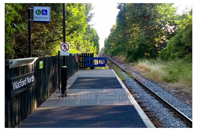
Nestled in the Hertfordshire suburb of North Watford, Watford North railway station holds a quiet significance. It's the very first stop on the Abbey Line, a charming branch line that meanders from Watford Junction to St Albans Abbey. You'll find it right next to the Bushey Mill Lane Level crossing.

While the line connecting Watford Junction to St Albans first opened its doors in 1858, Watford North station itself didn't arrive until October 1910. Back then, it was known as Callowland, reflecting the developing residential and industrial landscape of north Watford. This name stuck until 1927, when it was aptly renamed North Watford, a title it's proudly held ever since.

For decades, Watford North has stood resilient. It’s been unmanned since the infamous Beeching cuts of the early 1960s and has bravely fended off numerous closure threats over the years, a testament to its enduring role for local residents.

There have been whispers and plans for improvements along the Abbey Line and at the station in recent years, though none have come to fruition just yet. Ideas have included a nearby passing loop to boost service frequency from the current 45-minute intervals to less than 30, and even a proposal to run trams along the route. There was also a notable plan to extend the branch line to terminate at St Albans City Railway Station, which would undoubtedly enhance connectivity.

These pictures, offering a snapshot of Watford North, were captured with my Sony phone on July 9th, 2018. Clicking any of the images below should open a link in another window to my Colin Green Photography store on Zazzle.


Please take a moment to share this post, follow me on social media, and explore my work on Photo4Me and Clickasnap using the links below. Your support means a lot!


All the pictures remain the copyright of Colin Green.

Saturday, 28 September 2019

A Fond Farewell to J300 RAJ

It's funny how a single picture can unlock a flood of memories. Recently, I stumbled upon a photo that took me right back to my final days at RAJ Transport, a company I was proud to work for for over 11 years. The star of the show in that picture? J300 RAJ, my trusty chariot.

The End of an Era

RAJ Transport closed its doors in November 2018, but unlike many transport companies, it wasn't due to financial woes. The reason was far simpler, and in its own way, heartwarming: Bob, the boss, decided it was time to enjoy a well-earned retirement. It was a testament to the company's success and Bob's leadership that he could make such a decision.

A Unique Sight on the Motorway

This particular photo was taken a few months before the company closed. Normally, the trailers we ran were unbranded, just a distinctive yellow stripe against a green curtain. But on this day, I had one of only a couple of sign-written trailers hitched to my unit as I headed down to Wolverhampton from Huddersfield. It only struck me as I pulled into Stafford services southbound. I grabbed my camera, snapped a shot of the truck and trailer, and then, until now, completely forgot about it.

After a little digital tidying up, removing some of the colour from the trees in the background, this is the result. It's a bittersweet image now, a distant memory of a company that was genuinely enjoyable to work for. I just wanted to share it, as it brought back so many good times.

Clicking the image should open a link in another window to my Colin Green Photography store on Zazzle.


Please take a moment to share this post, follow me on social media, and explore my work on Photo4Me and Clickasnap using the links below. Your support means a lot!


The picture remains the copyright of Colin Green.

Sunday, 22 September 2019

A Journey Through Brontë Country: Discovering Waterfalls and Wuthering Heights

Recently, while sifting through some old photos, I stumbled upon a collection I took in March 2014. These weren't just any pictures; they were from a memorable walk across the moors south of Haworth, a journey undertaken in search of the elusive Brontë Waterfall and the haunting ruins of Top Withens farmhouse. I've compiled a selection of these images into a short video, which you can now view below.

The Brontë Waterfall: A Hidden Gem

Our adventure began at the Brontë Waterfall, a modest yet captivating cascade nestled in the heart of Brontë Country. This area, renowned for its stunning natural beauty, holds deep connections to the legendary Brontë family. You'll find the falls are part of the picturesque South Dean Beck. Interestingly, the original bridge crossing the beck was swept away by flash flooding in 1989, only to be lovingly rebuilt the following year. A plaque now stands as a testament to its resilience.

Following the Trail to Top Withens

From the waterfall, we followed the Brontë Trail in a westerly direction, leading us deeper into the moorland expanse and eventually to the atmospheric ruins of Top Withens Farmhouse. It's truly difficult to fathom how anyone could have carved out a life in such a desolate and isolated spot, with only a couple of other farms for company – farms that were themselves abandoned in the 1870s and subsequently demolished.

Top Withens met a similar fate, abandoned around the same time. However, it experienced a brief revival in 1920 when a Mr. Ernest Roddie brought it back into use. Alas, its respite was short-lived, and by 1926, the farm was finally abandoned for good, left to slowly succumb to the elements and become the ruin we see today. This poignant shell of a home is widely believed to have been the inspiration for the iconic Earnshaw house in Emily Brontë's timeless novel, Wuthering Heights.


The pictures below are of the ruins at Top Withens. The full set can be seen in my earlier post on Top Withens. Clicking any of them should open a link in another window to my Colin Green Photography store on Zazzle.


The full set of 12 pictures at Top Withens can be seen on Clickasnap or my earlier blog post.

Please take a moment to share this post, follow me on social media, and check out my work on Photo4Me and Clickasnap using the links below.


All the pictures remain the copyright of Colin Green.

Saturday, 23 March 2019

Tracing the Lost Rails: A Journey Along the Rishworth Branch Line

Imagine a time when the rhythmic clatter of trains echoed through the valleys of Calderdale, connecting communities and commerce. That vision was partially realized with the Rishworth Branch Line, a double-track railway that snaked its way from Sowerby Bridge through the charming villages of Triangle and Ripponden, eventually terminating at Rishworth, near Slitheroe Bridge.

The ambition for this line was even grander. The original plan envisioned a seamless connection to the main line at Smithy Bridge, Greater Manchester, by courageously tunnelling under the vast expanse of the moor. Sadly, despite extensive surveys, this grand design was ultimately abandoned. Cost overruns and persistent landslip issues on the already constructed sections proved insurmountable hurdles – a perpetual challenge for railway engineers in this rugged terrain.

The Rishworth Branch Line itself opened in two stages. The initial section, connecting Sowerby Bridge to Ripponden, welcomed its first trains in 1878. Just three years later, in 1881, the final stretch to Rishworth was completed. Over time, further stations were added to serve the growing needs of the communities, with Triangle gaining a station in 1885 and Watson Crossing Halt in 1907.

However, the railway's life was relatively short-lived. By the end of the First World War, the line was already experiencing a decline in usage. Passenger services ceased entirely in 1929, a testament to changing transportation patterns and the rise of road travel. Goods services continued for a while longer, serving Rishworth until 1953 and Triangle and Ripponden until September 1st, 1958.

Between 1958 and 1961, the tracks were progressively removed, and the line was ultimately abandoned, left to be reclaimed by nature. Yet, even today, remnants of this industrial past can be found. Many of the sturdy bridges still stand, as does the enigmatic Scar Head Tunnel (though now inaccessible). Even the station platform at Rishworth, though heavily overgrown, remains as a silent sentinel to a bygone era.

One can't help but wonder about the "what ifs." Had the line been completed to Lancashire, connecting to the broader network, would it still be open today? Perhaps a single, strategically placed station serving the vibrant communities of Triangle, Ripponden, and Rishworth could have ensured its longevity. It must have been a great regret for the railway company that their vision for a fully connected route never materialized.

I've put together a video from my YouTube channel that explores this fascinating lost line. It features a blend of historical images from when the line was in full operation, alongside photographs I took in 2013 and 2017 along the disused trackbed, showcasing how nature has slowly reasserted itself.

Join me on this virtual journey as we trace the ghost of the Rishworth Branch Line and reflect on its legacy in the landscape of Calderdale.


The images from 2013 and 2017 are my own personal pictures, the pictures taken from the days of the lines operation I searched for as public domain and believe them to be so, if I am incorrect I will be happy to add a credit to the video for the pictures owner.

Please take a moment to share this post, follow me on social media, and explore my work on Photo4Me and Clickasnap using the links below. Your support means a lot!


Friday, 22 March 2019

A Town Holds Its Breath: Sowerby Bridge and the March 2019 Flood Scare

The memories of Boxing Day 2015 are still vivid for many in Sowerby Bridge, a day when floodwaters ravaged the town. So, when days of relentless rain in mid-March 2019 caused the Rochdale Canal and the Rivers Calder & Ryburn to swell, a collective sense of unease, and then alarm, rippled through the community.

On March 16th, 2019, as the water levels steadily climbed, residents watched with bated breath. The fear of a repeat of 2015 was palpable. I was there, documenting the unfolding situation, and captured video clips of that anxious night and the morning after.

The first video, which I've uploaded to YouTube, truly shows the town as the levels were rising. You can see the sheer volume of water and the immediate concern it generated.


And the next 2 show Mearclough Bridge and Sowerby Bridge Cricket Ground on the nights when the levels were rising and the morning after when the rivers were much lower.


Thankfully, by the morning after, the town breathed a collective sigh of relief. The worst had been averted, but the experience served as a stark reminder of Sowerby Bridge's vulnerability to the power of nature.

Please take a moment to share this post, follow me on social media, and explore my work on Photo4Me and Clickasnap using the links below. Your support means a lot!


A Winter's Tale at Willow Hall Dam

Looking back a year, I'm reflecting on a set of pictures I captured at Willow Hall Dam in Sowerby Bridge. The winter of 2018 felt like it would never end, delivering snow and cold seemingly endlessly. Now, after a much milder UK winter, I can honestly say I have no nostalgia for how truly awful the weather was! It's funny how a few inches of snow can bring the entire country to a standstill, isn't it? We Brits do have a unique obsession with the weather, even when it's just a bit out of the ordinary.


More Than Just a Dam

Willow Hall Dam is actually two distinct bodies of water. The lower dam serves as a popular fishing lake, while the upper one, looking somewhat overgrown, primarily feeds it. I'm not entirely sure of the dam's original purpose, but with a number of now-vanished mills nearby, I'd hazard a guess it was once crucial for powering local industry.

Surrounded by woodland on three sides, the dam is a favourite spot for locals out walking their dogs. Dam Head Road runs directly across the top of the dam, with terraced housing flanking both sides of the dam head, adding to the picturesque, quintessentially British landscape.

These particular photos were taken on the 18th of March, 2018, using my Nikon D3300 SLR camera. Despite the lingering winter chill, there's a certain beauty to the stark, snow-dusted scenery. It's a reminder of a winter that certainly made its mark, even if we're all happier with the milder weather this year!

Clicking any of the images below should open a link in another window to my Colin Green Photography store on Zazzle.


Please take a moment to share this post, follow me on social media, and explore my work on Photo4Me and Clickasnap using the links below. Your support means a lot!


All the pictures remain the copyright of Colin Green.

Tuesday, 26 February 2019

Lost Lines and Echoes of Steam: A Journey Through Calderdale's Railway Heritage

Calderdale, with its dramatic valleys and industrial past, was once a thriving hub of railway activity. Today, I'm excited to share a project that sheds light on this rich history: a short YouTube video slideshow titled "Railway Stations of Calderdale."

This isn't just any slideshow; it's a comprehensive visual journey featuring public domain pictures of nearly every single railway station that has ever served an area of Calderdale. From grand Victorian structures to humble halts, this collection paints a vivid picture of a rail network that once crisscrossed our region.

What's even more remarkable is the sheer scope of this project. Out of all the stations that existed, there were only four that I couldn't track down a public domain image for: Brighouse Clifton Road, Halifax Shaw Syke, Rochdale Road Halt (Stainland Branch), and West Vale Station. For every other station, I managed to find at least one photograph, and crucially, the video also includes a current picture of every station that remains open today. To help you trace their stories, opening and closing dates are included with each image, alongside the estimated re-opening date for Elland, which is currently projected for 2022.

A Heritage Lost, and a Future Imagined

Watching this slideshow is a bittersweet experience. It starkly highlights the magnificent railway heritage that, sadly, we largely 'chucked away' in this area. Of all the closed stations, only Elland and potentially Hipperholme stand a chance of ever seeing trains again.

Imagine the possibilities if we had 'land banked' those closed lines and stations. We could have been looking at a revived Queensbury Lines, with Holmfield or Ovenden Stations providing an invaluable extra route to the north via Keighley. The Pickle Bridge line, with its Baliff Bridge or Clifton Road Stations, could have offered much-needed extra capacity on the route between Huddersfield and Bradford. Think of the impact on road congestion if we had added extra stations at Luddendenfoot, Cornholme, or Portsmouth (Lancs), or at Norwood Green or Lightcliffe.

This video isn't just a nostalgic trip; it's a poignant reminder of what was and a prompt to consider what could have been. It underscores the importance of preserving our infrastructure and planning for the future.

Take a moment to explore Calderdale's railway past – you might be surprised by what you discover!


Please take a moment to share this post, follow me on social media, and explore my work on Photo4Me and Clickasnap using the links below. Your support means a lot!


Tuesday, 19 February 2019

Exploring the Ryburn Valley Reservoirs: Baitings and Ryburn

Join me on a picturesque journey around two of the stunning reservoirs nestled in the Ryburn Valley: Baitings Reservoir and Ryburn Reservoir. These images were captured back in July 2018 using my trusty Nikon D3300 camera, a perfect companion for exploring the beautiful Calderdale landscape.

Ryburn Reservoir: A Timeless Water Source

Our exploration begins with Ryburn Reservoir, a vital water source built in 1933. It's gracefully surrounded by a tapestry of ancient woodland and open rural fields, making it a truly tranquil spot. Located just south of the A58, on the edge of the charming village of Ripponden, Ryburn was originally constructed to supply fresh water to the people of Wakefield. There are numerous walking paths around the dam, inviting you to wander through its serene surroundings. For those feeling adventurous, you can even climb further up the valley to reach the higher Baitings Reservoir.

Baitings Reservoir: Head of the Valley

Continuing our ascent, we arrive at Baitings Reservoir, which opened a little later in 1956. Also built to supply Wakefield, Baitings sits proudly at the head of the Ryburn Valley, primarily fed by the River Ryburn itself, along with several smaller streams.

Baitings holds a fascinating secret: during periods of exceptionally low water levels, the original bridge crossing becomes visible. While the water levels were too high to reveal it during this particular visit in July 2018, I was fortunate enough to capture a picture of it on a subsequent trip, which I'll be sure to share with you all very soon in a future post!

These two reservoirs offer not just essential resources, but also incredible beauty and a chance to connect with nature right here in West Yorkshire.

Clicking any image below should open a link in another window to my Colin Green Photography store on Zazzle.


The pictures above are Baitings Reservoir.


The previous 6 pictures were taken. at Ryburn Reservoir.


Baitings Reservoir in the distance from Ryburn Reservoir.


The previous 3 pictures are Ryburn Reservoir.


Ryburn Reservoir.


Baitings Reservoir.


Baitings Reservoir.


Baitings Reservoir.


Back o'the Heights Road Bridge.


The previous 4 pictures are taken around Baitings Reservoir.

Please take a moment to share this post, follow me on social media, and explore my work on Photo4Me and Clickasnap using the links below. Your support means a lot!


All the pictures remain the copyright of Colin Green.

A Glimpse into London's Past: Unpacking a Postcard of Hyde Park Corner

There's something uniquely captivating about old postcards. More than just a simple message carrier, they offer a tangible link to the p...