
The Spen Valley Greenway, a linear park stretching for roughly 8 miles across West Yorkshire, offers a unique blend of nature, history, and urban convenience. It follows the former route of the Spen Valley Railway, a line that once connected Low Moor to Ravensthorpe. Having already explored the section from Low Moor to the M62, I recently ventured out on a crisp December day to walk the next stretch: from the motorway bridge to the old site of Cleckheaton Central Railway Station. The journey proved to be a quiet, reflective ramble through a landscape transformed.
A Ghost of a Railway
The Spen Valley Railway, originally known as the Mirfield and Low Moor Railway, was a vital artery for the region. It first opened in 1848, with a branch line added a year later. At its peak, it served eight stations, connecting bustling towns like Cleckheaton, Liversedge, and Heckmondwike. Passenger services ceased in 1965, a casualty of the Beeching cuts, and freight traffic ended in the late 1980s. The track bed, left to nature, became a linear wilderness until Sustrans acquired it in 1998, transforming it into the greenway we know today.
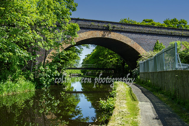
As you walk this section, the history of the line is ever-present. You pass beneath a series of bridges—some rust-stained steel girders, others crafted from brick or stone—that once carried roads and people over the railway. These structures, including the one at Whitcliffe Road, are a powerful reminder of the route’s industrial past, now softened by time and greenery. Occasional remnants of the railway, like old sleepers and signal posts, are still visible if you look closely, adding to the feeling of walking through a living museum.
From M62 to Cleckheaton Central
Starting just north of the colossal M62 bridge, the path narrows and the air grows quiet. This initial stretch feels more enclosed, with thickets of trees and undergrowth creating a natural tunnel. Graffiti-covered concrete walls flank the path, a modern counterpoint to the area's history. As you proceed, the path gently meanders, and the sound of traffic fades into the background.
The walk is surprisingly flat, a testament to the engineering of the original railway. The route's gentle curves take you past open fields and through wooded sections where the winter sun casts long shadows across the gravel track. It’s here you can appreciate the work that went into converting the overgrown trackbed into a smooth, accessible route for cyclists and walkers. You'll see locals out for a stroll or a bike ride, proving the greenway's success as a community resource. Before you know it, you arrive at the former site of Cleckheaton Central Railway Station. There's no grand station building here anymore; instead, you find a paved platform area with benches and railings. It's a poignant space, as if the ghosts of commuters and steam trains still linger. Adjacent to the site is a large supermarket, a stark symbol of how the landscape has evolved. The railway has been replaced by a new form of commerce, but the greenway ensures the corridor itself remains a vital link for the community.
The Future of the Line
It’s interesting to note that there are ongoing discussions about reopening parts of the line. With a population of over 50,000 people along the Spen Valley route and limited rail access, both heavy and light rail proposals are being considered. Walking the greenway, it’s easy to see the potential. The track bed is largely clear and unbuilt upon, offering a tantalizing glimpse of what a restored rail service could be. It's a testament to the foresight of those who preserved this route that such a conversation is even possible.
For now, the Spen Valley Greenway stands as a perfect example of repurposing. It’s a route for commuters, a place for exercise, a corridor for nature, and a living piece of history all in one. Whether you’re a local or just passing through, it's a fantastic way to spend a few hours, connecting with the past while enjoying the present.


In a tale that sounds like something from a mystery novel, British Rail's demolition crew arrived at the site in August 1971, only to find nothing but an empty plot. The station had vanished. It turns out, a different contractor had already "cleared" the site over three weeks, a job for which they were never paid.
This remarkable incident led to a court case in 1972 at Wakefield Crown Court, where a contractor was accused of stealing the station—or, more accurately, its stone, timber, and metal fittings. He claimed he had been hired by an untraceable third party, a story the court believed. He was found not guilty, a victim of a very unusual scam that left him out of pocket but free of a criminal record.
To this day, the case of Cleckheaton Central remains a unique footnote in British history: the only time a railway station was stolen. It's a fittingly strange end for a piece of industrial heritage that has been so beautifully repurposed into the Spen Valley Greenway.


%2012%20x%208.jpg)
%2012%20x%208%20copy.jpg)
%2012%20x%208.jpg)
%2012%20x%208.jpg)


